The Korean Peninsula is divided into two regions separated by a dividing line. This territory line is widely known as the Demilitarized Zone, or DMZ.
The DMZ spans 250 kilometers from the west coast to the east coast. Reaching a width of about 4 kilometers, it cuts across the land around the 38th Parallel.
The area serves as a primary buffer zone to separate the territories of South Korea and North Korea. It stands as a territorial marker as well as a witness to the shared history of both countries to this day.
History Behind the Dividing Line
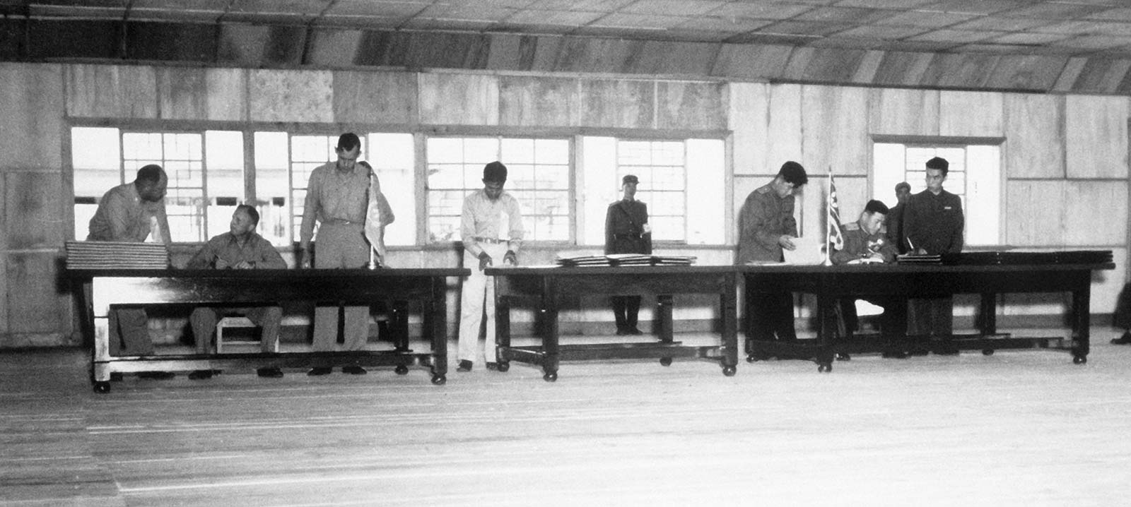
The DMZ was officially established on July 27, 1953. Its creation marked the end of open hostilities in the Korean War, which had been ongoing since 1950.
Military representatives from the United Nations, North Korea, and China signed the Armistice Agreement. The ceasefire agreement completely halted all military confrontations along the border area.
The buffer zone was created by pulling military forces back 2 kilometers on each side. This withdrawal aimed to minimize the risk of follow-up armed clashes on the ground.
The division of the Korean Peninsula also separated many families across the north and south. Since then, communication and movement for residents in the border area could no longer take place freely.
To date, the ceasefire agreement has never been updated into a permanent peace treaty. This status leaves the border area continuously holding potential tensions between the two nations.
Inside the DMZ
The name Demilitarized Zone literally translates to an area free from military activity. Reality on the ground shows extremely tight security surveillance all around it. The outer sides of the zone are fenced with thick barbed wire and guarded by strict checkpoints.
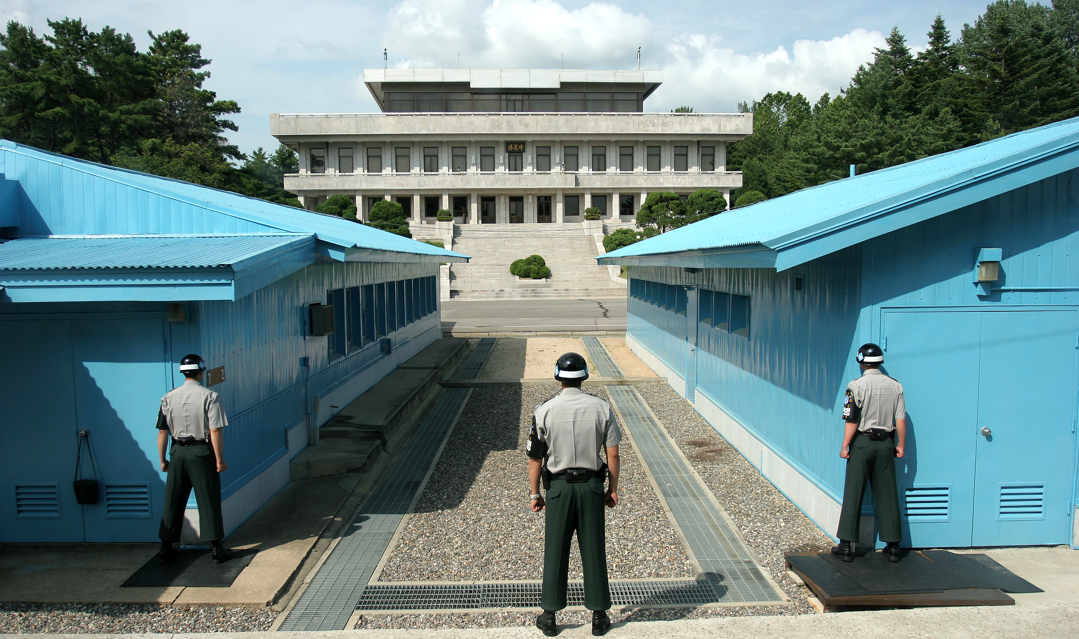
Inside this area lies a specific point called the Joint Security Area, or JSA. The JSA is located in the Panmunjom region. It serves as the primary meeting ground where forces from both sides historically stand in close proximity.
The JSA functions as the main site for diplomatic agendas and negotiations between high-level officials. The iconic blue barracks buildings serve as neutral ground for official interactions.
In April 2018, the JSA witnessed a historic moment during the Inter-Korean Summit. North Korean leader Kim Jong-un stepped across the concrete border marker into southern territory to meet South Korean President Moon Jae-in.
That moment was met with an invitation from Kim Jong-un for Moon Jae-in to step briefly across the border into northern territory. The event became an important symbol of diplomatic communication for both countries in the border zone.
Residential Life Along the Border
Despite its status as a conflict-prone area, civilian settlements operate close to the DMZ path. Two villages stand very close on either side of the boundary line.

On the South Korean side lies Daeseong-dong Village, inhabited by a local farming community. Residents living there receive exemptions from state taxes and mandatory military service.
Daily activities for Daeseong-dong residents are governed by strict security regulations from military authorities. They must observe night curfews and receive direct escorts while working their farmland.
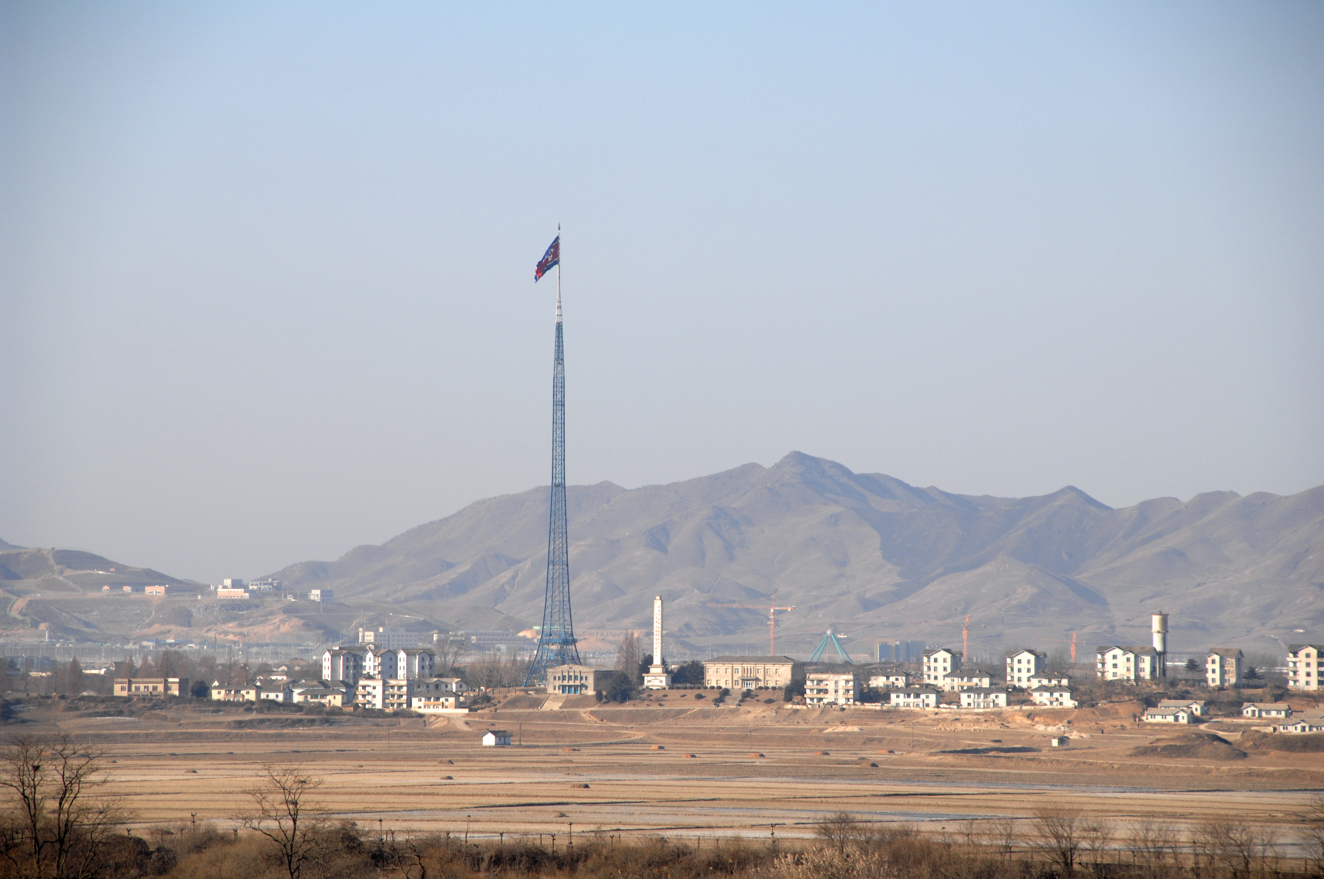
North Korea has a residential settlement named Kijong-dong Village just beyond the boundary line. The village features multi-story buildings and a 160-meter-tall flagpole.
Kijong-dong Village was constructed by the North Korean government as a border residential zone. The existence of this village symbolizes a civilian presence along North Korea's border.