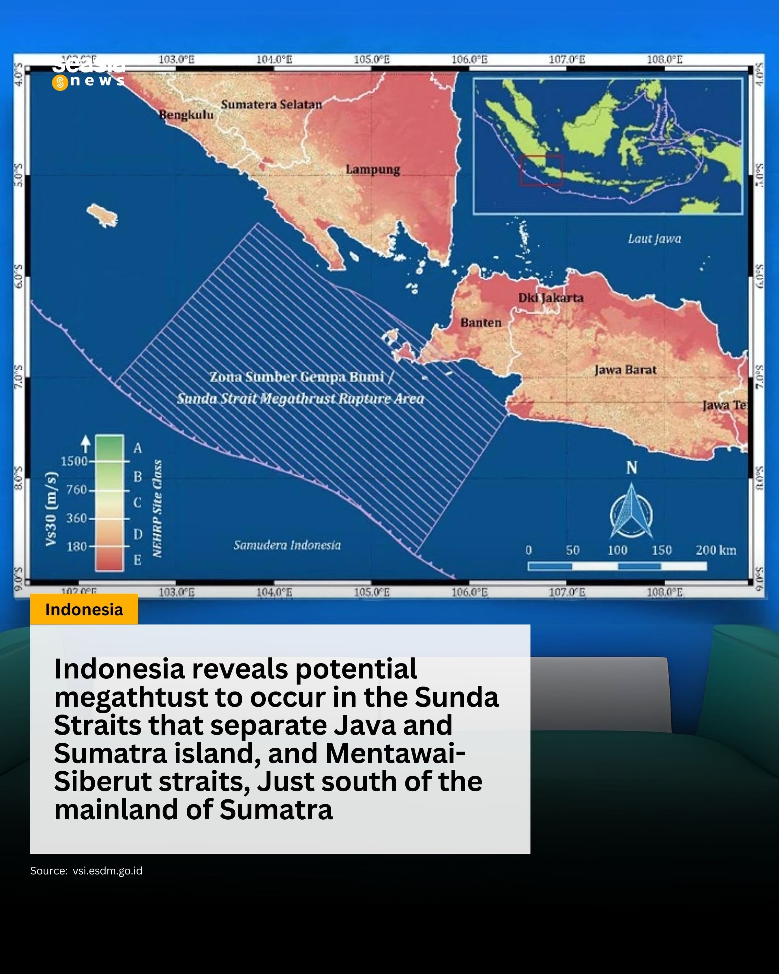
Indonesia's Meteorology, Climatology, and Geophysics Agency Issues Warning on Potential Megathrust Earthquakes
The Meteorology, Climatology, and Geophysics Agency of the Republic of Indonesia (BMKG) has warned all Sunda Strait and Mentawai-Siberut region residents concerning the potential threat of megathrust earthquakes. These earthquakes are predicted to originate from two critical points, with an estimated magnitude exceeding 8.0.
Megathrust earthquakes are a type of seismic activity that occurs due to the collision of tectonic plates, where one tectonic plate is forced underneath another. The anticipated megathrust earthquakes hold the potential to cause severe tremors, leading to significant infrastructure damage and substantial economic impact.

Read also: What is a Megathrust Earthquake That is Said to Occur in Indonesia
Context of the Warning
The BMKG's warning to the public follows the 7.1 magnitude earthquake that struck Japan on August 8, 2024. The concern regarding megathrust earthquakes is based on a cycle that occurs approximately every few hundred years.
In the megathrust zones of Sumatra and Java, these earthquakes are known to have a cycle ranging between 200 to 250 years. This warning also highlights the potential for a tsunami, which is now considered a matter of when not if.
Read also: About the Earthquake in the Sunda Strait and Mentawai-Siberut Which is "Just a Matter of Time"
Clarifying the Term "A Matter of Time"
However, it is important to clarify that the phrase "a matter of time" does not imply that a large-magnitude, tsunami-inducing earthquake is expected imminently.
According to Daryono, Head of the Earthquake and Tsunami Center at BMKG, the exact timing of such an earthquake cannot be predicted.
While it is acknowledged that the two megathrust zones in Indonesia (Sunda Strait and Mentawai-Siberut) are overdue for seismic activity, predicting the occurrence remains beyond current scientific capabilities.
Read also: 2017 Indonesia Earthquake Source and Hazard Map
Historical Context and Seismic Activity
Drawing from the 2017 Indonesia Earthquake Source and Hazard Map, the last recorded earthquakes in the Sunda Strait and Mentawai-Siberut megathrust segments occurred over 200 years ago.
The Sunda Strait segment, which spans 200 km in width and 280 km in length, experienced megathrust earthquakes in 1699 and 1780 with magnitudes of 8.5 Mw (Moment Magnitude).
In contrast, the Mentawai-Siberut segment of the Sumatra megathrust, with dimensions of 200 km by 200 km, witnessed earthquakes in 1797 and 1833, with magnitudes of 8.7 Mw and 8.9 Mw, respectively.


