

Borders are more than just lines on a map, they are the result of centuries of history, politics, geography, and sometimes conflict. Among the nearly 200 countries on Earth, some share borders that stretch thousands of kilometers across plains, mountains, forests, and rivers.
The longest land borders are often between large countries with expansive territories. Here are the most significant and lengthy land borders in the world.
Canada and United States

The longest international land border in the world is between Canada and the United States which is stretching for 8,891 kilometers.
This border includes both the main boundary between the continental U.S. and Canada, as well as the border between Alaska and the Canadian Yukon and British Columbia.
This vast border is largely undefended, a symbol of the peaceful relationship between the two countries. Despite its length, it is relatively lightly populated in many areas, especially in the rugged and remote western and northern regions.
The Canada–U.S. border is also famous for the Peace Arch and the iconic border crossing between Blaine, Washington and Surrey, British Columbia.
Kazakhstan and Russia
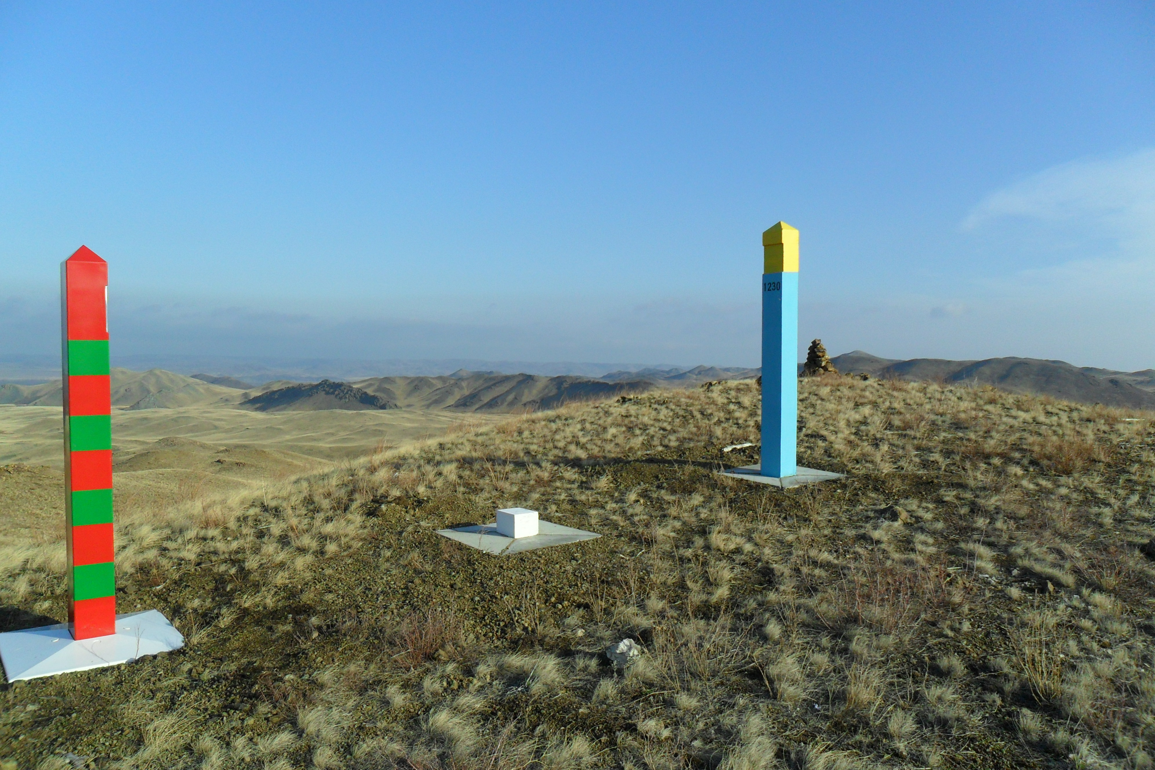
The second longest land border in the world is between Kazakhstan and Russia, measuring about 7,644 kilometers. This border spans across Eurasian steppes and deserts, and it is the longest continuous land border between two countries entirely within one continent.
Historically, the relationship between these two nations was shaped by their shared history under the Soviet Union.
After Kazakhstan gained independence in 1991, this border became international, and the two countries have maintained strong diplomatic and economic ties since.
Argentina and Chile

The Argentina–Chile border is the longest in South America and one of the most dramatic in terms of geography. It stretches about 5,308 kilometers along the Andes Mountains, which form a natural barrier between the two nations.
This mountainous border includes some of the highest peaks in the Americas, such as Aconcagua. While the terrain makes large-scale crossing difficult, it also offers some of the most stunning landscapes on the continent.
Argentina and Chile have had historical disputes over parts of the Andes, but today they maintain a largely peaceful and cooperative relationship.
China and Mongolia

The China–Mongolia border is one of the longest in Asia, running approximately 4,677 kilometers. It separates the vast deserts and grasslands of Mongolia from the northern provinces of China.
Much of the border runs through remote and sparsely populated areas, including the Gobi Desert.
Historically, this region has seen waves of nomadic tribes and imperial armies moving back and forth. Today, the border is more defined and guarded, though trade and movement continue through designated crossings.
India and Bangladesh

Measuring around 4,096 kilometers, the India–Bangladesh border is one of the most unique and complex in the world.
It is the longest border India shares with any neighbor and is known for its numerous enclaves and counter enclaves which are small pockets of territory completely surrounded by the other country.
These geographical oddities were largely resolved in 2015 through a landmark land boundary agreement. The border runs through dense population areas, rivers, forests, and agricultural land, making it one of the most heavily monitored and sensitive borders globally.
Russia and China

The Russia–China border, stretching about 4,209 kilometers, marks the boundary between two of the largest and most powerful nations in Eurasia. This border was once a flashpoint during the Cold War, particularly in the 1960s when border clashes occurred.
However, over time, both countries have worked to settle disputes and develop closer strategic ties. The border follows several rivers, including the Amur and Ussuri, and passes through remote and often harsh terrain.
Brazil and Bolivia

In South America, the Brazil–Bolivia border stretches approximately 3,403 kilometers. It crosses dense rainforest and river systems in the Amazon Basin.
This border region is ecologically rich but also presents challenges in terms of governance, law enforcement, and development.
Both countries cooperate on issues such as deforestation, indigenous rights, and regional trade, although illegal activities like drug trafficking remain a concern in some areas.


