

Did you know? Centuries ago, Southeast Asia was home to a city with a population similar to, or even greater than, the great cities of Europe. That city was Angkor, the former capital of the Khmer Empire in present-day Cambodia.
According to research published in Science Advances, Angkor is estimated to have housed between 700,000 and 900,000 people at its peak in the 13th century. This population was ten times larger than that of London at the same time, which had only around 80,000 inhabitants.
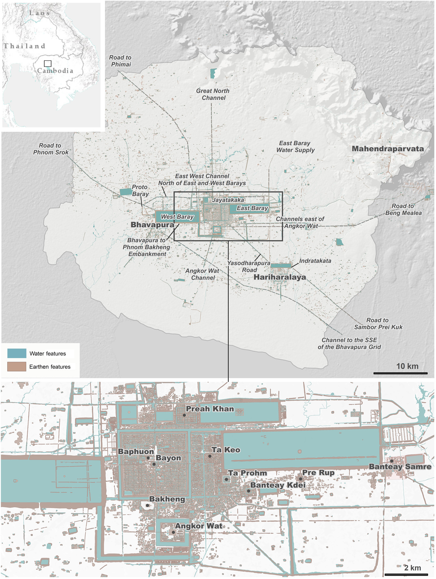
Angkor is believed to have been the most densely populated city in the world during its era, with a metropolitan area spanning 3,000 square kilometers.
The Lost Giant City in the Jungle
Angkor was not just a temple complex, it was a thriving ancient metropolis. As reported by the BBC, the city stretched as far as the eye could see, with an extensive network of roads, canals, reservoirs, and massive dams that sustained its population. This urban layout has led modern researchers to describe Angkor as one of the earliest examples of a “low-density city,” where settlement was spread across a vast area.
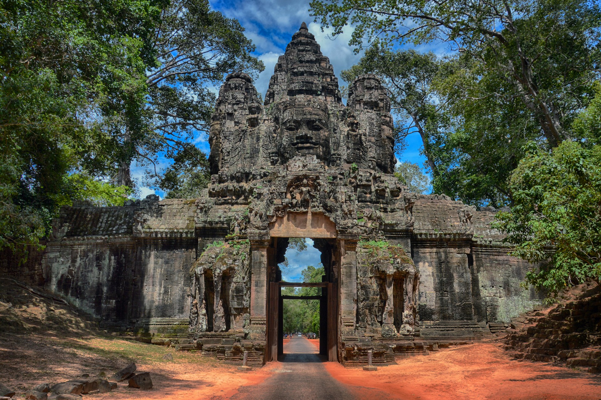
At the city’s heart stood Angkor Wat, a masterpiece of architecture commissioned in the early 12th century by King Suryavarman II. Originally dedicated to the Hindu god Vishnu, it later became a Buddhist temple. With its five towers symbolizing the peaks of Mount Meru, Angkor Wat served not only as a spiritual center but also as a political and cultural emblem of Khmer power.
Modern Technology Unlocks an Ancient Mystery
One of the greatest mysteries of Angkor has long been the true size of its population. The challenge, as The Conversation explains, lies in the fact that most homes were built from organic materials such as wood and bamboo. Unlike the enduring stone temples, these everyday structures left no lasting traces, forcing scholars for centuries to rely only on speculation.
However, advancements in modern technology have finally shed light on this mystery. Using lidar—airborne laser scanning—archaeologists were able to “peel back” the dense jungle canopy covering Angkor. The scans revealed clear patterns of ancient roads, mounds of former houses, and remnants of agricultural fields that once supported the city’s vast population.
These findings were then combined with traditional archaeological excavations. Citing research by Dr. Sarah Klassen of the University of British Columbia in Science Advances, this integration of modern data and classical methods produced the first truly comprehensive demographic model of Angkor.
The results were astonishing: at the height of its glory, Angkor housed between 700,000 and 900,000 people, a number rivaling even ancient Rome at its peak.
Life in Angkor: From Palaces to Rice Fields
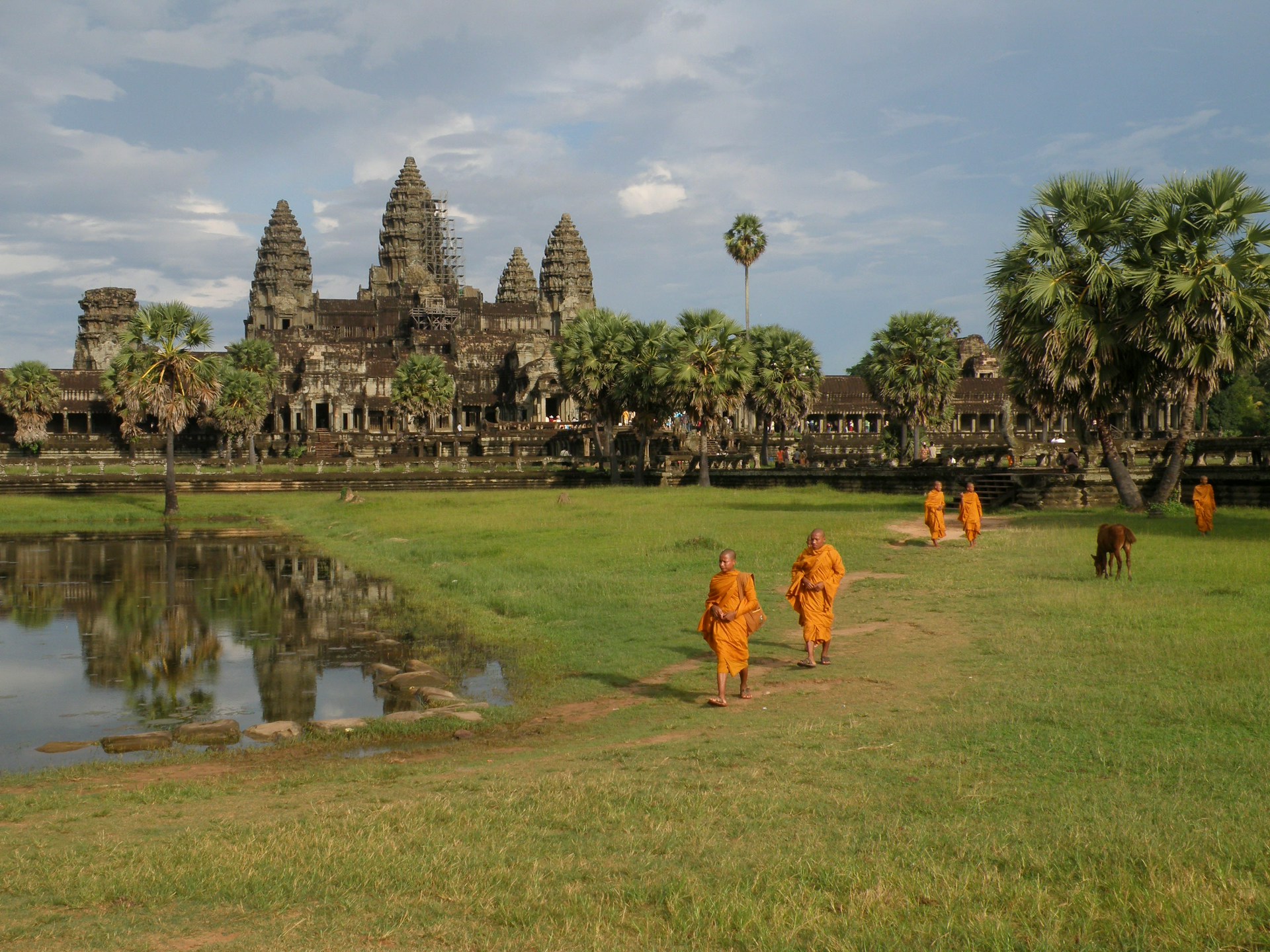
Life in Angkor was divided into several layers of society. At the heart of the city—the so-called civic-ceremonial center—stood grand temples such as Angkor Wat and Bayon. According to The Conversation, this area was home to royal officials, artists, dancers, and priests who sustained the empire’s spiritual and political life.
Meanwhile, in the wider metropolitan area, the majority of the population were rice farmers. A sophisticated irrigation system enabled abundant harvests to support the needs of this giant city.
The BBC also notes that traders lived along the embankments of roads and canals, fueling Angkor’s commercial activity. In other words, Angkor was not only a center of government and religion but also the beating economic heart of the region, connected to broader trade networks.
From Glory to Decline
History shows that no greatness lasts forever. Angkor’s downfall was driven by a combination of factors: climate change that disrupted the monsoon cycles, the overburdening of its irrigation system by a swelling population, and deforestation that degraded soil quality.
External pressures also hastened its decline. In 1431, the Ayutthaya Kingdom from the north invaded and conquered Angkor in retaliation for rebellion. From then on, the Khmer capital was relocated to Phnom Penh, leaving Angkor to be slowly reclaimed by the tropical jungle.
From “Lost City” to Global Icon
Yet Angkor’s story did not end there. The BBC records that in 1586, Portuguese monk António da Madalena was among the first Europeans to witness the grandeur of Angkor Wat, describing it as a monument that “cannot be described with a pen.”
Later, in the 19th century, French explorer Henri Mouhot introduced Angkor Wat to the Western world, writing that the temple was more magnificent than the ruins of Greece or Rome. From then on, Angkor once again captured global attention.
In the early 20th century, the French colonial administration began restoration efforts with tourism in mind. Although these efforts were disrupted by civil war and the Khmer Rouge regime, Angkor Wat largely survived, even bearing bullet scars on its outer walls.
Angkor Today: Cambodia’s National Identity
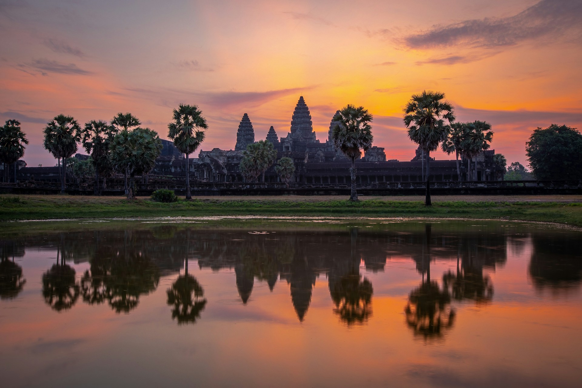
Today, Angkor Wat is more than an archaeological site, it is a national symbol of Cambodia. Inscribed as a UNESCO World Heritage Site in 1992, it has become a global tourist magnet. Many visitors even wake before dawn just to witness the sunrise behind the temple’s iconic silhouette.
Reference:
- https://www.science.org/doi/10.1126/sciadv.abf8441
- https://www.bbc.com/culture/article/20170309-the-mystery-of-angkor-wat
- https://theconversation.com/a-metropolis-arose-in-medieval-cambodia-new-research-shows-how-many-people-lived-in-the-angkor-empire-over-time-157573


