


Rivers shape landscapes, sustain ecosystems, and support human civilizations, but some of them hold remarkable secrets beneath their surfaces.
Among the world’s many waterways, a select few stand out for their extraordinary depth, plunging hundreds of meters below ground level.
These deep channels influence biodiversity, navigation, and regional cultures in profound ways. We will explore the ten deepest rivers on Earth, highlighting their unique characteristics, geographic importance, and the vital roles they play across continents.
1. Congo River
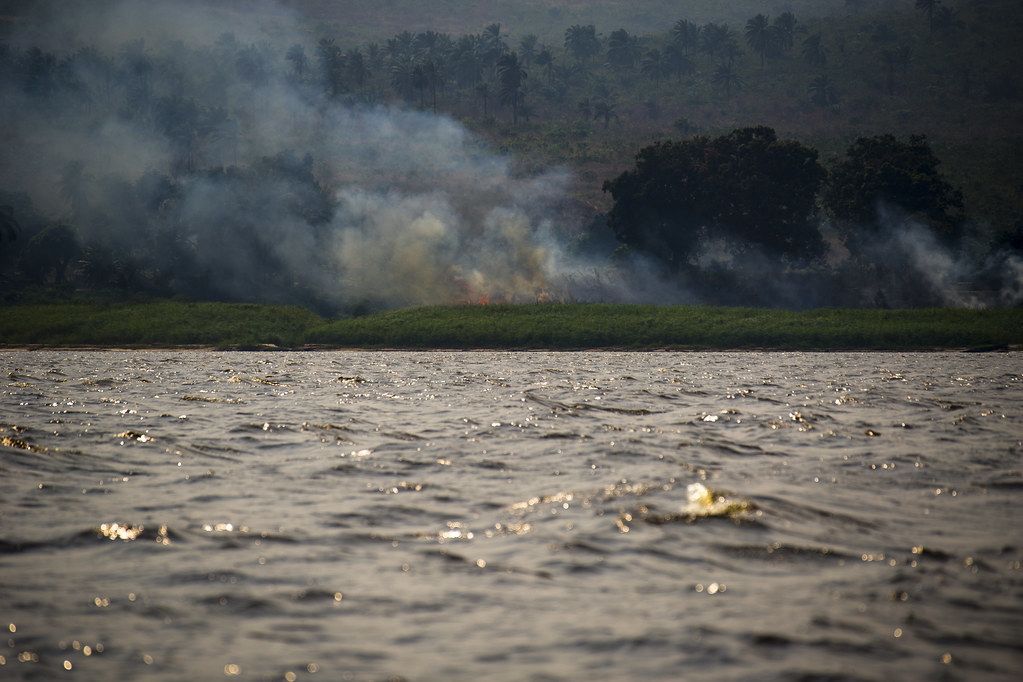
The Congo River, flowing through Central Africa, is recognized as the world’s deepest river, plunging to about 220 meters.
Its vast basin stretches across the Democratic Republic of the Congo, the Republic of the Congo, and Angola, collecting runoff from one of the planet’s largest rainforest regions.
It is also the second-longest river in Africa and among the greatest in the world by discharge. Its immense depth results from steep underwater canyons and turbulent stretches such as those near Livingstone Falls.
These dramatic geological features carve profound channels that support complex aquatic habitats and influence the river’s powerful flow.
2. Yangtze River

China’s Yangtze River ranks second, with depths reaching roughly 200 meters. Originating high on the Tibetan Plateau, it travels more than 6,300 kilometers before emptying into the East China Sea.
The river drains a vast portion of China’s landmass and sustains nearly a third of the nation’s population.
Its middle region, particularly the Three Gorges area, features some of the most rugged terrain along the river, helping explain both its depth and its rapid currents. Throughout history, the Yangtze has been vital to transportation, agriculture, and cultural development.
In modern times, it remains a centerpiece of hydropower production, most notably through the Three Gorges Dam, which dramatically reshaped both the landscape and regional economies.
3. Brahmaputra River

The Brahmaputra River takes third place, descending to around 135 meters near Sadiya in India. Beginning as the Yarlung Tsangpo in the high Himalayas, it cuts through deep mountain gorges before entering India’s Assam Valley and eventually joining the Ganges in Bangladesh.
Known for its braided channels, enormous discharge, and intense seasonal floods, the Brahmaputra shapes some of South Asia’s most fertile floodplains. It supports major agricultural systems, abundant fisheries, and dense human settlements.
Its changing pathways and powerful monsoon swells illustrate both its ecological richness and the challenges it presents to the millions who rely on its waters.
4. Amazon River
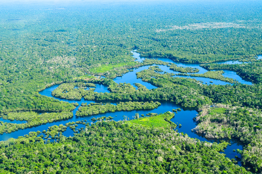
The Amazon River ranks fourth, reaching depths of roughly 124 meters near its lower course in Brazil.
As the river with the world’s largest watershed, it feeds and drains the immense Amazon rainforest, receiving water from an intricate network of tributaries across several South American countries.
This depth and its extraordinary volume enable significant navigation, providing access for ships traveling from the Atlantic deep into South America.
The Amazon also depends on seasonal flooding cycles that replenish nutrients and support vast floodplain forests, making the river central not only to commerce but also to the ecological rhythms of the largest tropical rainforest on Earth.
5. Zambezi River

In fifth place is Africa’s Zambezi River, which sinks to around 116 meters as it courses between Zambia and Zimbabwe. Originating in Zambia, it flows across several national boundaries before reaching the Indian Ocean.
Famous for features like Victoria Falls and the Barotse floodplain, the Zambezi nurtures diverse wildlife and supports communities through fishing, agriculture, and tourism.
The river is also heavily utilized for hydropower, with massive dams such as Kariba and Cahora Bassa shaping economic growth but also altering natural habitats and river dynamics.
6. Mekong River

The Mekong River of Southeast Asia holds sixth position, reaching depths of about 100 meters. Its 4,350-kilometer journey spans China, Myanmar, Laos, Thailand, Cambodia, and Vietnam.
The Mekong’s basin is one of the most biodiverse freshwater ecosystems on the planet and supports one of the world’s largest inland fisheries. Tens of millions rely on its seasonal floods for food production and livelihoods.
Yet the river now faces increasing pressures from dam construction, sand mining, pollution, and climate-driven drought, resulting in disruptions to fish migrations and sediment cycles that have shaped regional cultures for centuries.
7. Orinoco River

Also reaching depths of around 100 meters, the Orinoco River of Venezuela and Colombia comes seventh on the list. Its wide basin nourishes rainforests, savannas, and wetlands, sustaining abundant wildlife.
Historically, the river provided crucial transportation routes, first for Indigenous communities and later for settlers and traders. Its deep waters allow the passage of large vessels, supporting regional commerce and connecting remote interior areas to coastal markets.
8. Danube River
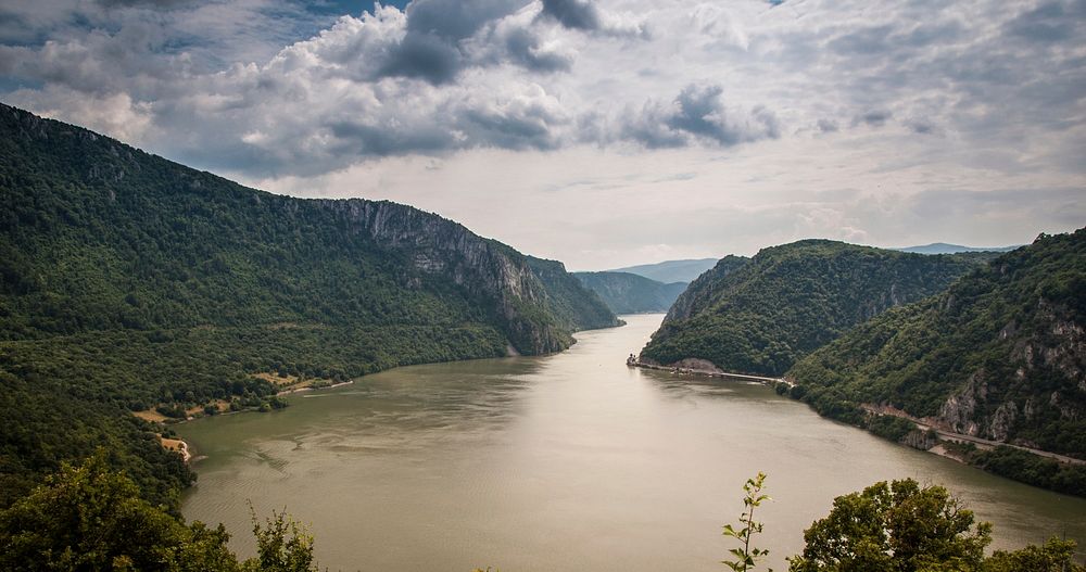
Europe’s Danube River ranks eighth, with depths of about 90 meters at the Iron Gates gorge between Serbia and Romania. Crossing or bordering ten countries, the Danube links Central and Eastern Europe and passes through several major capital cities.
Historically a frontier of the Roman Empire, it is now an essential waterway that connects to the North Sea through the Rhine–Main–Danube canal.
Although it remains vital for trade, agriculture, and industry, human alterations such as dams and channelization have degraded its floodplains and reduced fish populations.
9. Ottawa River

The Ottawa River in Canada also reaches depths near 90 meters. Flowing over 1,271 kilometers, it forms part of the boundary between Ontario and Quebec.
Long known to Indigenous peoples as the Great River, it later became a key transportation route for the fur trade and the timber industry.
Today, hydropower dams regulate much of its flow, shaping both energy production and the ecological health of surrounding wetlands and fisheries.
10. St. Lawrence River

The St. Lawrence River, at about 76 meters deep, completes the list. Serving as the outlet of the Great Lakes, it flows northeast toward the Atlantic and forms part of the border between Canada and the United States.
Historically important to Indigenous peoples and European explorers, it remains a major commercial waterway through the St. Lawrence Seaway. Its estuary supports a diverse range of wildlife, including whales and migratory birds, making it a vital ecological corridor.