For generations, the world admired Angkor Wat as a masterpiece of stone architecture, an iconic temple rising quietly from the jungles of Cambodia. But modern satellite imagery has rewritten that story.
When seen from orbit, Angkor reveals itself as something far more radical than a religious monument: it was one of the largest engineered urban systems ever built by pre-industrial civilization.
What appears on the ground as scattered temples is, from space, a carefully designed landscape stretching across roughly 3,000 square kilometers. Roads, canals, reservoirs, embankments, and moats form a single integrated system.
Angkor was not just a city, it was a vast hydraulic machine designed to control water, food, population, and power on a continental scale.
A Megacity Before Megacities Existed
At its peak between the 9th and 13th centuries, Angkor functioned as the political and economic heart of the Khmer Empire. Archaeological reconstructions suggest the urban area supported close to one million inhabitants, an almost unimaginable number for its time.
To put this into perspective, while Angkor was operating as a low-density megacity, London was home to only around 80,000 people. The difference was not just population size, but urban philosophy. Instead of dense stone blocks, Angkor spread outward, weaving agriculture, housing, and water management into one continuous system.
This scale remained hidden for centuries because Angkor was designed horizontally, not vertically. Only with the help of modern aerial mapping could scholars finally grasp its true dimensions.
Reading Angkor with Lasers from the Sky
The breakthrough came with the use of LiDAR, a remote sensing method that uses laser pulses to penetrate dense vegetation. When applied over Angkor, LiDAR stripped away the jungle canopy and exposed an invisible city beneath.
What emerged was astonishing: grids of ancient roads, neighborhood mounds, dams, and canals extending far beyond the famous temples. This proved that Angkor was not a ceremonial center surrounded by wilderness, but a fully planned urban landscape, arguably the world’s first true low-density metropolis.
From space, Angkor finally makes sense. On the ground, the temples feel monumental. From above, they are nodes within a massive system engineered to sustain human life at unprecedented scale.
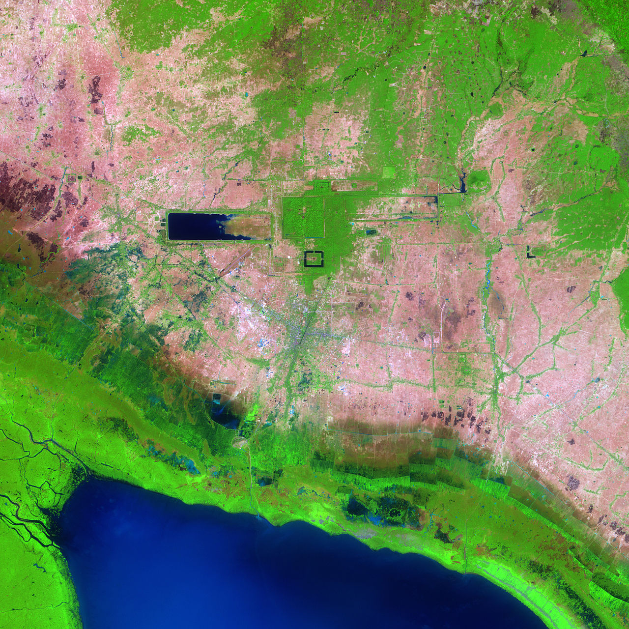
West Baray and the Logic of Water Power
One of the clearest signs of Angkor’s engineering ambition is the West Baray, a man-made reservoir measuring roughly 7.8 kilometers long and over 2 kilometers wide. Even today, its geometric shape is visible from satellite imagery.
This reservoir was not decorative. It functioned as the core of a three-tier water management network that regulated floods during the monsoon season and released water during dry months.
By stabilizing water supply, Angkor could harvest rice multiple times a year, an agricultural advantage that fueled population growth, political stability, and imperial expansion.
Water, in Angkor, was not a natural resource to be endured. It was a tool to be mastered.
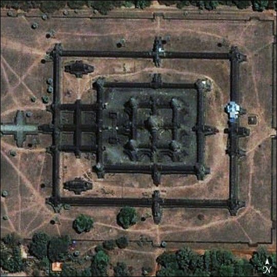
The Moats That Kept Stone from Sinking
Another engineering secret becomes obvious only when Angkor is viewed as a system rather than a single temple. The wide moats surrounding major structures were not merely symbolic or defensive features. They played a critical structural role.
Angkor sits on sandy soil vulnerable to seasonal expansion and contraction. The presence of water in surrounding moats helped stabilize underground moisture levels, preventing uneven ground pressure beneath the massive stone foundations.
In modern terms, the Khmer builders had already grasped principles of soil mechanics centuries before they were formally defined by science.
Without these water buffers, many of Angkor’s temples would likely have cracked, tilted, or collapsed long ago.
When the Machine Broke Down
Ironically, Angkor’s greatest strength also became its vulnerability. Satellite analysis reveals damaged canals, breached embankments, and abandoned hydraulic routes.
In the 14th century, the region experienced prolonged droughts followed by extreme flooding. The intricate system, optimized for balance, struggled to adapt to rapid climate instability.
Once water control failed, agriculture declined, food shortages emerged, and the city gradually emptied, not through sudden conquest, but through systemic collapse. Angkor was not destroyed. It was switched off.
Seeing Angkor the Way It Was Meant to Be Seen
Today, Angkor reminds Southeast Asia, and the world, that advanced urban engineering is not a modern invention. Long before satellites, steel, or concrete, Khmer civilization built a functioning megasystem powered by water, geography, and deep environmental knowledge.
To truly understand Angkor, one must look beyond the temple walls and, metaphorically, rise above the jungle. Only from space does its full ambition come into focus: a city designed not just to inspire the gods, but to organize an entire civilization.