


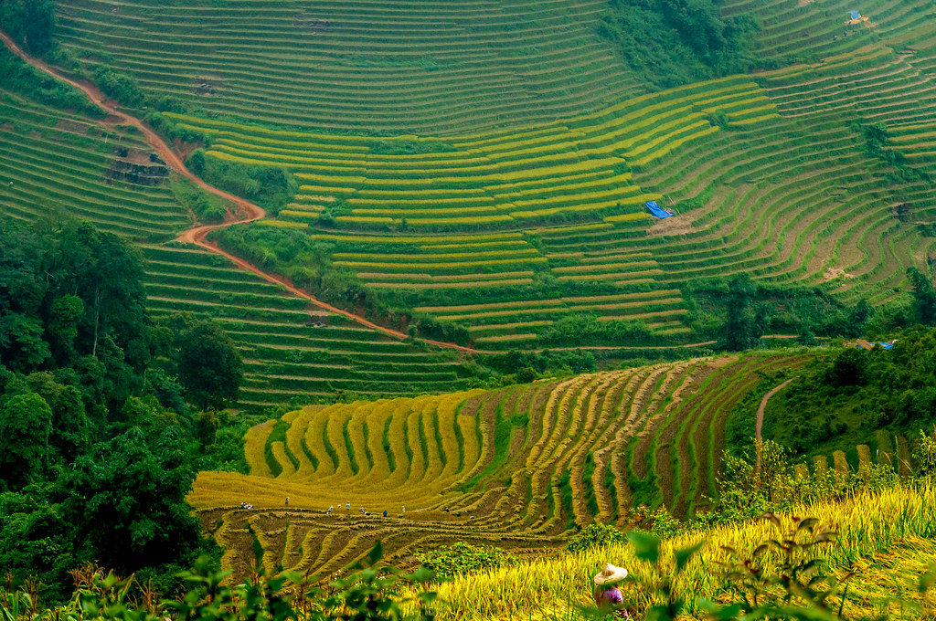
High in the Hoàng Liên Sơn mountain range of northern Viet Nam, the terraced hills of Sa Pa unfold like a vast three-dimensional topographic map.
From above, the land appears carved into flowing contour lines, each level tracing the rise and fall of the mountains with remarkable precision.
The terraces curve and stack upon one another, mirroring the logic of elevation lines on a map, yet they are entirely organic, shaped by human hands responding to steep slopes and seasonal rhythms.
This unique visual effect is what makes Sa Pa instantly recognizable and endlessly captivating for anyone who visits.
Where Geography and Human Ingenuity Meet
The beauty of Sa Pa’s terraces lies not only in their appearance but in the relationship they reveal between people and terrain.
Farming on such dramatic slopes would seem nearly impossible without reshaping the land, and over generations, local ethnic communities transformed mountainsides into productive fields.
Each terrace is carefully leveled to hold water and soil, creating a staircase of arable land that follows the mountain’s natural contours.
Seen together, these steps form patterns that resemble relief maps brought to life, demonstrating how geography can guide, rather than limit, human creativity.
Changing Colors Across the Seasons

One of the most striking qualities of Sa Pa’s terraced hills is how dramatically they change throughout the year.
In spring, when water floods the fields in preparation for planting, the terraces reflect the sky like thousands of small mirrors, amplifying the sense of depth and dimension.
Meanwhile, summer brings vibrant green rice shoots that soften the sharp lines into waves of color.
By autumn, the hills glow with gold as the rice ripens, the contours becoming more pronounced as light and shadow play across the slopes. Each season redraws the map, offering a new version of the same landscape.
Mist, Light, and the Illusion of Depth

Sa Pa is famous for its shifting mountain mist, which adds another layer to the topographic illusion. In the early morning, clouds drift through the valleys, partially obscuring lower terraces while higher ones emerge like islands.
This creates a strong sense of vertical layering, much like viewing a relief model with elevation emphasized.
As sunlight breaks through the fog, shadows slide along the curves of the hills, accentuating their three-dimensional form. The constant movement of mist and light ensures that the landscape never looks the same twice.
Cultural Imprints on the Hillsides

The terraces are inseparable from the cultures that built and maintain them. Ethnic groups such as the Hmong, Dao, and Tay have farmed these hills for centuries, embedding their knowledge, rituals, and labor into the land itself.
Footpaths cut across the terraces like fine lines on a map, connecting villages and fields. Traditional houses perch along ridges, positioned with an intuitive understanding of elevation and drainage.
This cultural presence adds meaning to the visual beauty, reminding visitors that the landscape is not a static artwork but a living environment shaped by daily life.
A Viewpoint That Rewards Perspective

From valley floors, the terraces rise in steep walls, emphasizing their scale and complexity. From higher viewpoints, especially along mountain passes or ridgelines, the full topographic effect becomes clear.
The hills stretch outward in layered arcs, their geometry becoming more abstract and map-like. Photographers and hikers are often drawn to these vantage points, where the interplay of distance and elevation turns farmland into something resembling a sculptural installation.
It is in these moments that Sa Pa most strongly evokes the feeling of standing inside a three-dimensional map.
More Than a Scenery

The terraced hills of Sa Pa are beautiful not simply because they are visually striking, but because they embody balance. They show how humans can adapt to challenging environments without erasing their natural character.
The resemblance to a 3D topographic map is a reminder that the land’s form was respected, traced, and enhanced rather than flattened or ignored.
In Sa Pa, beauty emerges from harmony between slope and step, mountain and field, nature and culture, offering a landscape that is both practical and profoundly poetic.