


Around two thousand years ago, long before maps depicted Southeast Asia as a whole, the same island was known by four different names in four civilizations that had no direct contact with one another.
Greek and Roman geographers called it Chryse and Barousai. Sanskrit scholars in India referred to it as Suvarnadvipa. Chinese court chroniclers recorded it as Kantoli and later Foshi. Arab and Persian merchants knew it as Zabag and Lamuri.
That island was Sumatra.
References to it appear across a span of more than 700 years. The earliest dates to the 1st century CE, when Greek and Roman sailors wrote about a golden island at the eastern edge of their known world. The latest comes from the 9th century, when Arab merchants recorded firsthand accounts of a powerful kingdom across the Strait of Malacca.
What makes this sequence of records remarkable is not only its age. The four accounts were also independent of one another. Geographers in Alexandria, Sanskrit scholars in India, Chinese court historians, and merchants from Siraf were not copying each other's writings.
They all arrived at descriptions of the same island through the Indian Ocean trade network, which had already connected much of the ancient world without the writers themselves fully realizing it.
The Earliest Western Records of Sumatra
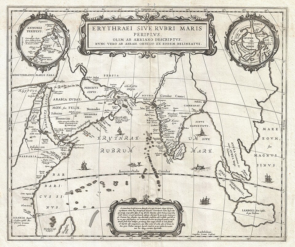
The earliest written reference comes from the Periplus of the Erythraean Sea, a Greek navigation guide dating to around the 1st century CE.
The text describes an island called Chryse, meaning "Golden Island," at the eastern edge of the world known to the Greeks and Romans. It was described as the source of the finest tortoiseshell along the maritime trade route stretching from the Red Sea to the Indian Ocean.
Many modern historians associate Chryse with Sumatra. However, the identification remains debated because the same name was also used for the Malay Peninsula.
About a century later, the Alexandrian geographer Claudius Ptolemy compiled his Geography (c. 150 CE). His work was based on information collected by Marinus of Tyre from merchants who had actually traveled to the region.
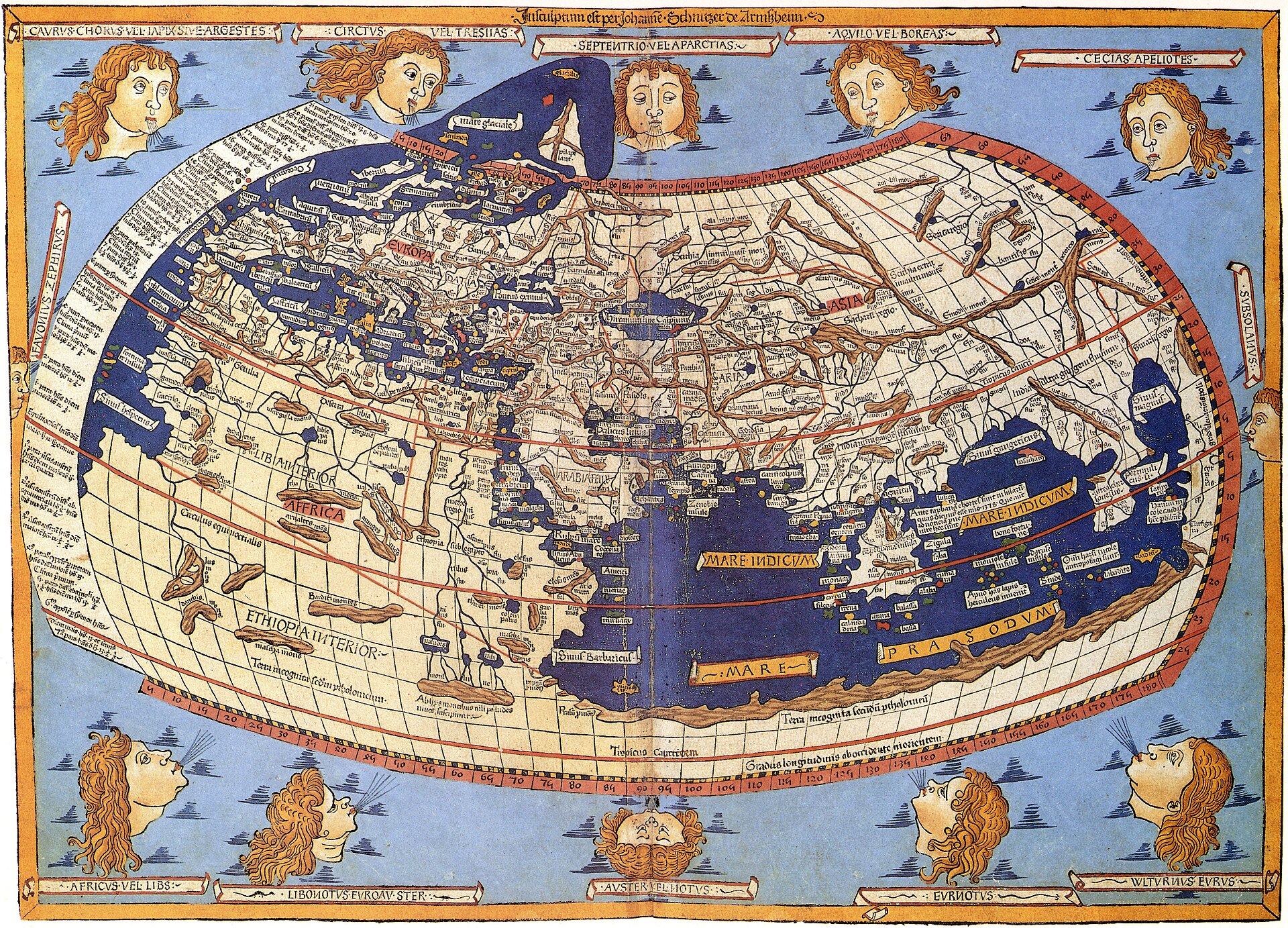
Ptolemy's account includes the name Barousai, which almost certainly refers to Barus, the camphor-producing port on the west coast of northern Sumatra. It also mentions Malaiou, which is widely believed to refer to the Malayu Kingdom in the interior of Sumatra.
In his classic study The Golden Khersonese (1961), historian Paul Wheatley argued that these records represent the earliest written references to specific locations on the island. Unlike earlier stories of a vague "Golden Island," they identify actual places in Sumatra.
Suvarnadvipa: the Golden Island in Sanskrit Literature
On the other side of the Indian Ocean, authors of ancient Indian literature referred to a place called Suvarnadvipa, meaning "Golden Island." The name appears in several texts, including the Ramayana, the Buddhist chronicle Mahavamsa, and the Jataka tales.
In one episode of the Ramayana, Sugriva sends his forces across the sea in search of Sita. Their journey takes them as far as Yavadvipa and the lands beyond it. This suggests that the authors of the text already had, at least, a vague idea of distant lands east of India.
The name Suvarnadvipa was later confirmed through epigraphic evidence as a designation for southern and central Sumatra. These regions were well known as sources of gold exported from their inland river systems.
In his study Suvarnadvipa and the Chryse Chersonesos, the scholar W. J. van der Meulen traced how the Sanskrit name Suvarnadvipa and the Greek name Chryse Chersonesos may have referred to overlapping geographical regions. This is particularly remarkable because the two names emerged from completely separate literary traditions.
Kantoli Sent Envoys to the Chinese Court
The earliest Chinese reference to Sumatra did not come from a travel account. Instead, it appeared in the bureaucratic records of the imperial court.
In 441 CE, a kingdom called Kantoli, believed to have been centered around present-day Jambi or Palembang, sent a tribute mission to the court of the Southern Liu Song dynasty in China. A second mission followed in 563 CE.
These diplomatic missions were later recorded in the Liang Shu, completed in 635 CE. The chronicle also listed the tribute items presented to the court, including camphor, agarwood, areca nuts, and pepper.
Two centuries later, Chinese accounts of Sumatra shifted from official court records to firsthand observations. The Buddhist monk Yijing stopped at a kingdom he called Foshi between 671 and 685 CE. He stayed there for six months to study Sanskrit grammar and the Malay language before continuing his journey.
Historian George Cœdès later identified Foshi as Srivijaya, the maritime kingdom centered around present-day Palembang.
In his 2013 study published in the Journal of Southeast Asian Studies, historian Derek Heng argued that the sequence of records on Kantoli and Foshi demonstrates that China had been monitoring political developments in Sumatra long before Srivijaya reached the height of its power.
Zabag and Lamuri in Arab–Persian Records
The most detailed written account actually came much later. It was written by the Persian merchant Sulaiman al-Tajir.
Around 851 CE, in his travel account Akhbar al-Sin wa al-Hind, he described a kingdom called Zabag. He wrote that its territory was so vast that even a fast ship would not be able to sail around it within two years.
Historian George Cœdès believed that Zabag referred to the heart of the Srivijaya kingdom in Sumatra. This was the same kingdom that the Buddhist monk Yijing had visited two centuries earlier.
Several centuries later, Arab geographers of the 10th to 13th centuries began recording the name Lamuri, or Lamri, for a kingdom located near present-day Banda Aceh. It served as the first landing point for merchant ships arriving from the west before they continued their voyage through the Strait of Malacca.
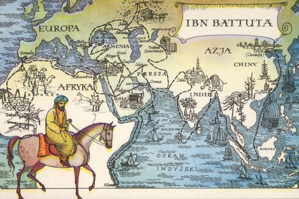
The same name was later recorded by the Moroccan explorer Ibn Battuta when he visited the northern coast of Sumatra in 1345–1346.
Confirmed Through Archaeology
These ancient accounts are not simply legends that were passed down through generations. Between 1995 and 2005, a joint team from the École française d'Extrême-Orient (EFEO) and Indonesia's National Research Centre for Archaeology excavated the Lobu Tua site near Barus.
The excavation uncovered ceramics, glassware, and coins from Persia, China, and India dating from the 9th to the 11th centuries. The discoveries were made at the very location that Ptolemy had identified as Barousai eight centuries earlier.
More recent evidence has come from the Bongal site in Central Tapanuli, which has been reexamined since 2019. Thousands of artifacts from the Middle East, India, China, and Europe have been discovered there.
The findings suggest that Sumatra's international trade network may have been active even before Barus emerged as a major port.
Four ancient civilizations recorded different names for the same island. Today, the archaeological record of Sumatra continues to confirm their accounts, one discovery at a time.
References:
- Wheatley, P. (1961). The Golden Khersonese: Studies in the Historical Geography of the Malay Peninsula before A.D. 1500. University of Malaya Press.
- van der Meulen, W. J. Suvarnadvipa and the Chryse Chersonesos. Indonesia (Cornell University Southeast Asia Program). https://ecommons.cornell.edu/server/api/core/bitstreams/8e21a153-37b2-4d87-8a77-1056b0b38b5f/content
- Heng, D. (2013). State formation and the evolution of naval strategies in the Melaka Straits, c. 500-1500 CE. Journal of Southeast Asian Studies, 44(3), 380-399. https://www.cambridge.org/core/journals/journal-of-southeast-asian-studies/article/abs/state-formation-and-the-evolution-of-naval-strategies-in-the-melaka-straits-c-5001500-ce/DFB9439FB1D515A7CD16862A18032F13
- Soedewo, E., Bakar, A., Intan, M. F. S., Purnawibowo, S., Restiyadi, A., & Setiawan, T. (2024). History of the west coast of North Sumatra before Barus: Preliminary results of archaeological research at the Bongal settlement site. Archipel, 107. https://journals.openedition.org/archipel/pdf/3932
- Ecole francaise d'Extreme-Orient & Pusat Penelitian Arkeologi Nasional. Lobu Tua: Sejarah Awal Barus. https://publications.efeo.fr/en/livre-pdf/665_lobu-tua-sejarah-awal-barus
- Association for Asian Studies. The Travel Records of Chinese Pilgrims Faxian, Xuanzang, and Yijing: Sources for Cross-Cultural Encounters Between Ancient China and Ancient India. https://www.asianstudies.org/publications/eaa/archives/the-travel-records-of-chinese-pilgrims-faxian-xuanzang-and-yijing-sources-for-cross-cultural-encounters-between-ancient-china-and-ancient-india/


