


Signing a treaty was much faster than mapping the mountains, rivers, and forests that actually defined the border described in it. Throughout the late nineteenth and early twentieth centuries, European colonial powers repeatedly established borders in Southeast Asia using the same approach.
They signed the treaty first and dealt with the technical details later.
The agreements usually provided only broad instructions, such as "follow this mountain ridge" or "follow that river." At that stage, no survey team had yet determined the exact location of the boundary on the ground.
Field surveys came afterward. Sometimes they took place years later. In some cases, they did not begin until decades after the treaty had been signed.
Three official publications from the U.S. Department of State clearly document this pattern along three different borders: Malaysia-Thailand, Indonesia-Malaysia, and Cambodia-Thailand.
1909: A Treaty That Explicitly Said "To Be Surveyed Later"
According to International Boundary Study No. 57, the Bangkok Treaty, signed by Britain and Siam on March 10, 1909, described the border between what are now Malaysia and Thailand entirely in words.
The treaty stated that the boundary began at the mouth of the Perlis River. It then followed the mountain ridges separating the watersheds before reaching the Golok River.
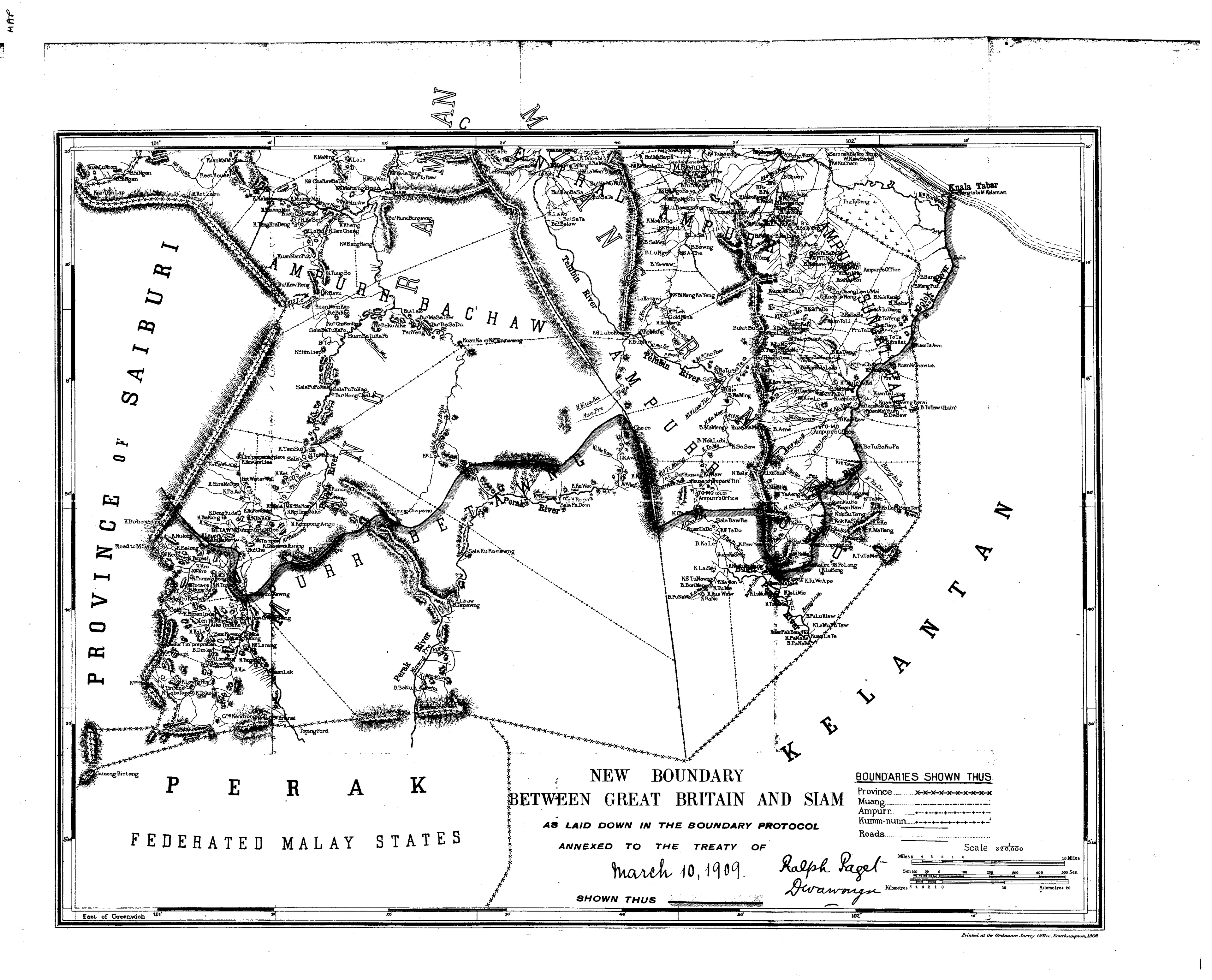
The agreement also transferred the four Malay kingdoms of Kedah, Kelantan, Perlis, and Terengganu from Siamese rule to British protection.
What makes the treaty particularly noteworthy is that it openly acknowledged that the fieldwork had not yet been completed. As quoted in the study, it stated:
"It shall be the duty of the Boundary Commission ... to determine and eventually to mark out the frontier above described,"
In other words, the responsibility for determining and physically marking the border was assigned to a special body known as the Boundary Commission. The commission only began its work after the treaty had been signed.
The sequence was therefore straightforward. The general concept was agreed upon on paper first. Only afterward did surveyors go into the field to translate it into an actual boundary.
1891: A Borneo Border Survey Completed 22 Years Later
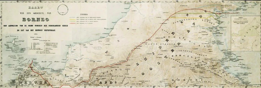
In some cases, the gap between signing a treaty and surveying the border was much longer. According to International Boundary Study No. 45, the London Convention signed by Britain and the Netherlands in 1891 established the boundary on Borneo using the limited geographic knowledge that existed at the time.
The study explains the problem in its own words:
"Due to the lack of specific knowledge of the geography of interior Borneo, certain difficulties soon arose over the 1891 delimitation,"
Because detailed knowledge of Borneo's interior was so limited, significant difficulties emerged as soon as the treaty was implemented on the ground.
To resolve those problems, Britain and the Netherlands established a joint commission to conduct a more detailed survey of the border. The commission completed its report in Tawao on February 17, 1913. That was twenty-two years after the original treaty had been signed in London.
1904-1907: When the Official Map Failed to Follow the Treaty
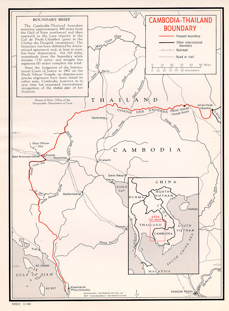
The most complicated case was not the delay between signing a treaty and surveying the border. It was the fact that the final map did not fully follow the treaty on which it was based.
According to International Boundary Study No. 40, the Franco-Siamese treaties of 1904 and 1907 established a simple rule for the Cambodia-Thailand border. The boundary was to follow the crest of the Dangrek Mountains, where the watershed divides rivers flowing in opposite directions.
The problem was that the commission responsible for preparing the official map did not always follow the actual mountain ridge. In several places, the map deviated from the true watershed.
Preah Vihear Temple was one of those locations.
In 1962, the International Court of Justice ruled that the commission's map, rather than the treaty's original wording, had legal force. The Court reasoned that Thailand had accepted the map by failing to protest it for decades.
That small cartographic error continued to have consequences more than a century later. It helped trigger major armed clashes throughout 2025, leaving more than 100 people dead and forcing over half a million civilians to flee their homes.
Three Borders, Three Different Outcomes
These three cases reveal the same pattern. Colonial powers signed treaties first and dealt with the technical details later. The consequences, however, depended on how carefully the process was carried out.
Along the Malaysia-Thailand border, the delay was openly acknowledged in the treaty itself. The responsibility for completing the survey was immediately assigned to a dedicated Boundary Commission.
On Borneo, the process remained unresolved for 22 years before a joint commission finally completed a detailed survey.
Along the Cambodia-Thailand border, the commission that was supposed to resolve the technical details instead produced a map that departed from the treaty's original instructions.
The discrepancy was not fully challenged until it reached the International Court of Justice more than five decades later. Even today, its consequences continue to affect hundreds of thousands of people.
References:
- U.S. Department of State, Office of the Geographer. International Boundary Study No. 57: Malaysia-Thailand Boundary. November 15, 1965. https://library.law.fsu.edu/Digital-Collections/LimitsinSeas/pdf/ibs057.pdf
- U.S. Department of State, Office of the Geographer. International Boundary Study No. 45: Indonesia-Malaysia Boundary. March 15, 1965. https://library.law.fsu.edu/Digital-Collections/LimitsinSeas/pdf/ibs045.pdf
- U.S. Department of State, Office of the Geographer. International Boundary Study No. 40 (Revised): Cambodia-Thailand Boundary. November 23, 1966. https://library.law.fsu.edu/Digital-Collections/LimitsinSeas/pdf/ibs040.pdf


