


Beneath the roads, houses and industrial landscape of North Jakarta lies the memory of a much older city—one shaped by rivers, maritime movement and an ambitious water project recorded in stone.
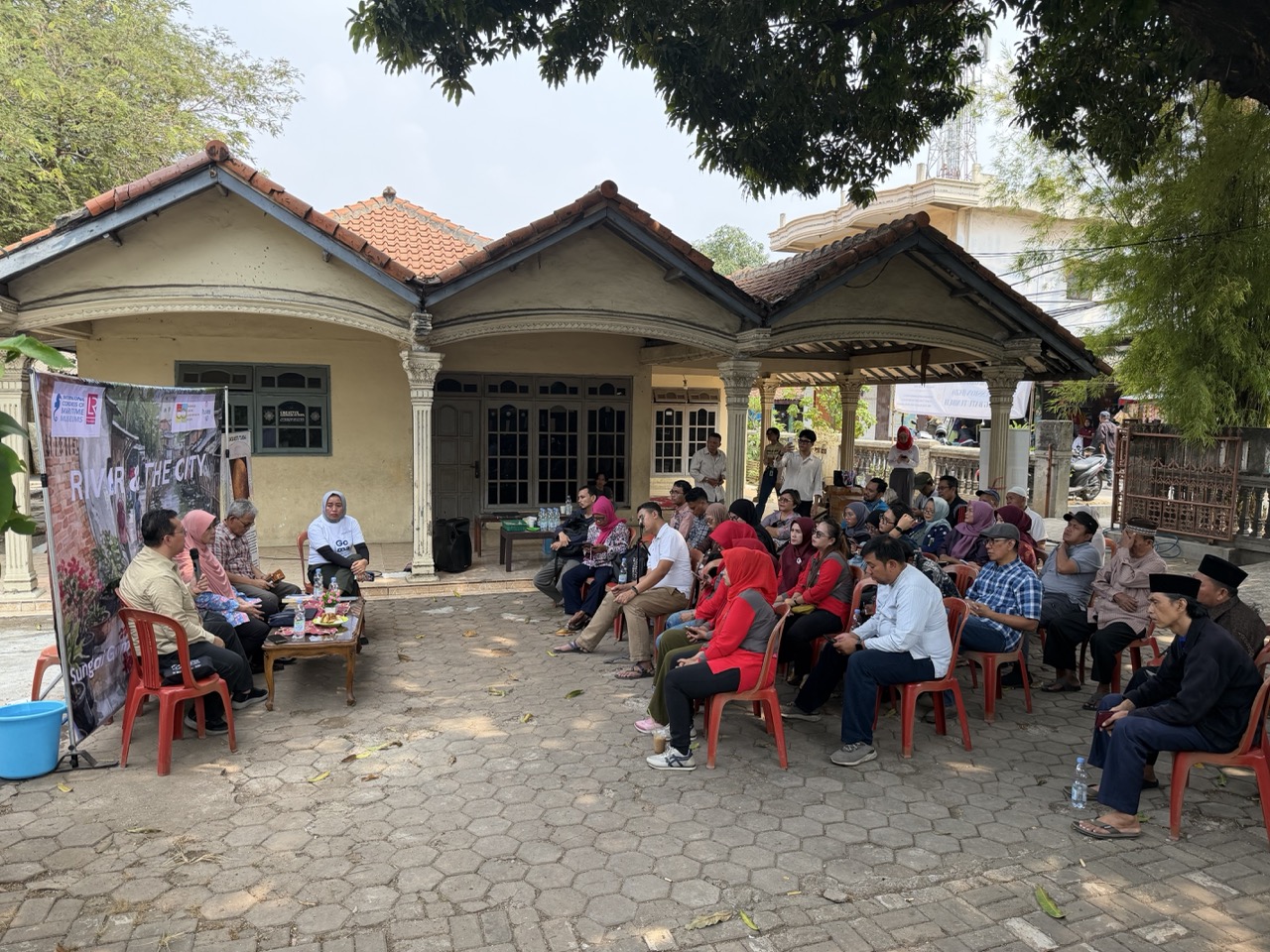
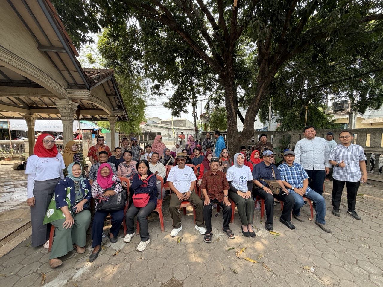
A focus group discussion held in Kampung Batu Tumbuh on September 12, 2026, brought residents, historians, archaeologists and government representatives together to recover the area’s history and advance plans for a community-based heritage center. The unusual outdoor gathering took place on the terrace of Ahmad Supyan’s home, shaded by a large mango tree and cooled by a gentle breeze, with the Gomati waterway visible nearby. Supyan belongs to one of only three long-established families still residing in the neighbourhood, with a lineage tracing back several centuries to the Dutch colonial era.
An Ancient Public Work Written in Stone
The strongest evidence of Batu Tumbuh’s early importance is the Prasasti Tugu, or Tugu Inscription, the longest surviving inscription associated with the Tarumanagara Kingdom. Carved around an egg-shaped boulder approximately one metre high, its five lines are written in Sanskrit using Pallava script and the Anustubh poetic metre.
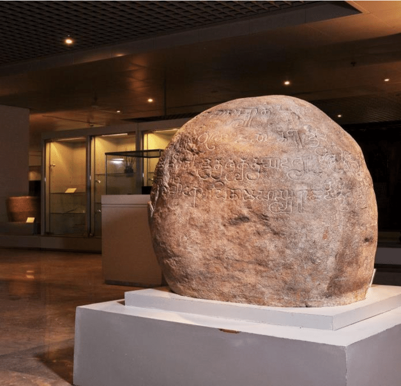
Palaeographic analysis places the inscription in the middle of the fifth century. It records two waterworks: the Candrabhaga channel, attributed to an earlier ruler known as Rajadirajaguru, and the Gomati, excavated under King Purnawarman during the 22nd year of his reign.
According to the inscription, the Gomati extended for 6,122 dhanus, or bows, a distance commonly estimated at around 11 kilometres. The work was completed in only 21 days. Its inauguration was marked by a religious ceremony in which 1,000 cows were presented to Brahmins.
The text does not provide a modern engineering explanation of the project. Historians have nevertheless interpreted the channels as part of a system for draining excess water, reducing seasonal flood risks and supporting agriculture during drier periods. This makes Prasasti Tugu one of the Indonesian archipelago’s earliest written records of organized water management.
Water Shaped the City Before Jakarta
The inscription changes the conventional starting point of Jakarta’s history. Long before Sunda Kelapa became a major port and centuries before the Dutch constructed Batavia, communities in the region were already organizing labour and modifying waterways on a considerable scale.
The Gomati project required authority, technical knowledge and the ability to mobilize workers rapidly. The donation of 1,000 cows also suggests access to substantial economic resources and illustrates how political power, public construction and Hindu religious ceremony reinforced one another.
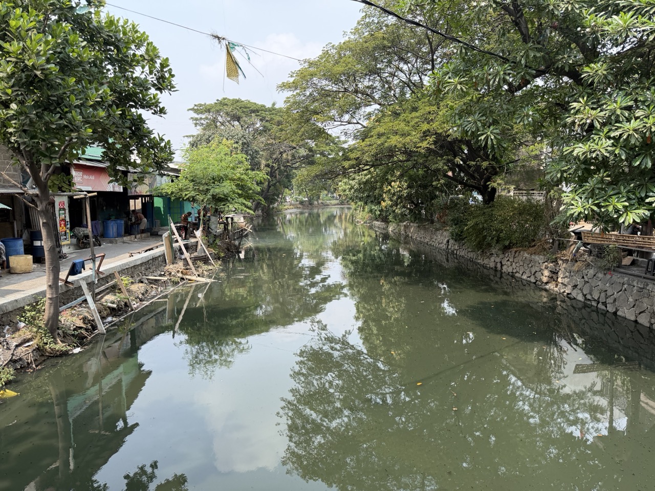
The Batu Tumbuh heritage initiative associates the ancient Gomati with the Old Cakung waterway. That connection gives residents a tangible route through which to explore the inscription’s landscape, although the precise relationship between the ancient channel and today’s river system requires further archaeological and hydrological study.
The question has contemporary weight. Statistics Indonesia estimated Jakarta’s population at approximately 10.68 million in 2024, including around 1.82 million people in North Jakarta. In such a densely inhabited coastal environment, the history of water cannot be separated from present discussions about flooding, drainage, land subsidence and resilient urban planning.
A Colonial Settlement Adds Another Layer
Batu Tumbuh’s history did not end with Tarumanagara. During the Dutch colonial period, the wider Tugu area became home to a distinctive community of Mardijkers—freed people with diverse Asian and Portuguese-speaking backgrounds who had previously lived under Portuguese and Dutch colonial systems.
In 1661, the Dutch East India Company transferred 23 Mardijker families to land outside Batavia. Their settlement developed traditions that remain associated with Kampung Tugu, including Keroncong Tugu, Portuguese-influenced family names, the former Papia Tugu creole and community celebrations such as Rabo-Rabo and Mandi-Mandi.
This colonial chapter also introduced new systems of administration, land classification and documentary ownership. As historian Bondan Kanumoyoso was scheduled to examine during the Batu Tumbuh discussion, colonial records eventually came to dominate written accounts of the area, sometimes obscuring older settlement patterns and contributing to the complicated roots of later agrarian disputes.
The Tugu Inscription itself entered the colonial scholarly record after being discovered in Batu Tumbuh in 1878. In 1911, the stone was transferred to the museum of the Bataviaasch Genootschap van Kunsten en Wetenschappen. It is now preserved at the National Museum of Indonesia under inventory number D.124.
The transfer protected the inscription, but it also separated the original object from the community and landscape that gave it meaning. The proposed heritage center offers an opportunity to reconnect the nationally important artifact with its local birthplace.
Residents Bring the Archive Home
The September discussion followed research conducted in 2025 by Musee ID with North Jakarta cultural authorities, the regional cultural-preservation office and the Ministry of Culture. That work produced the documentary Gomati dan Yang Terlupakan dari Jakarta Hari Ini, or Gomati and What Has Been Forgotten from Jakarta Today.
The FGD expanded the inquiry across several historical periods. University of Indonesia historian Susanto Zuhdi examined settlement from the Buni paleometallic culture through the Hindu-Buddhist, Islamic, colonial and modern eras. Archaeologist Titi Surti Nastiti discussed Tarumanagara’s hydrological knowledge and the landscape in which Prasasti Tugu was created, while Kanumoyoso explored the Mardijker settlement and colonial land administration.
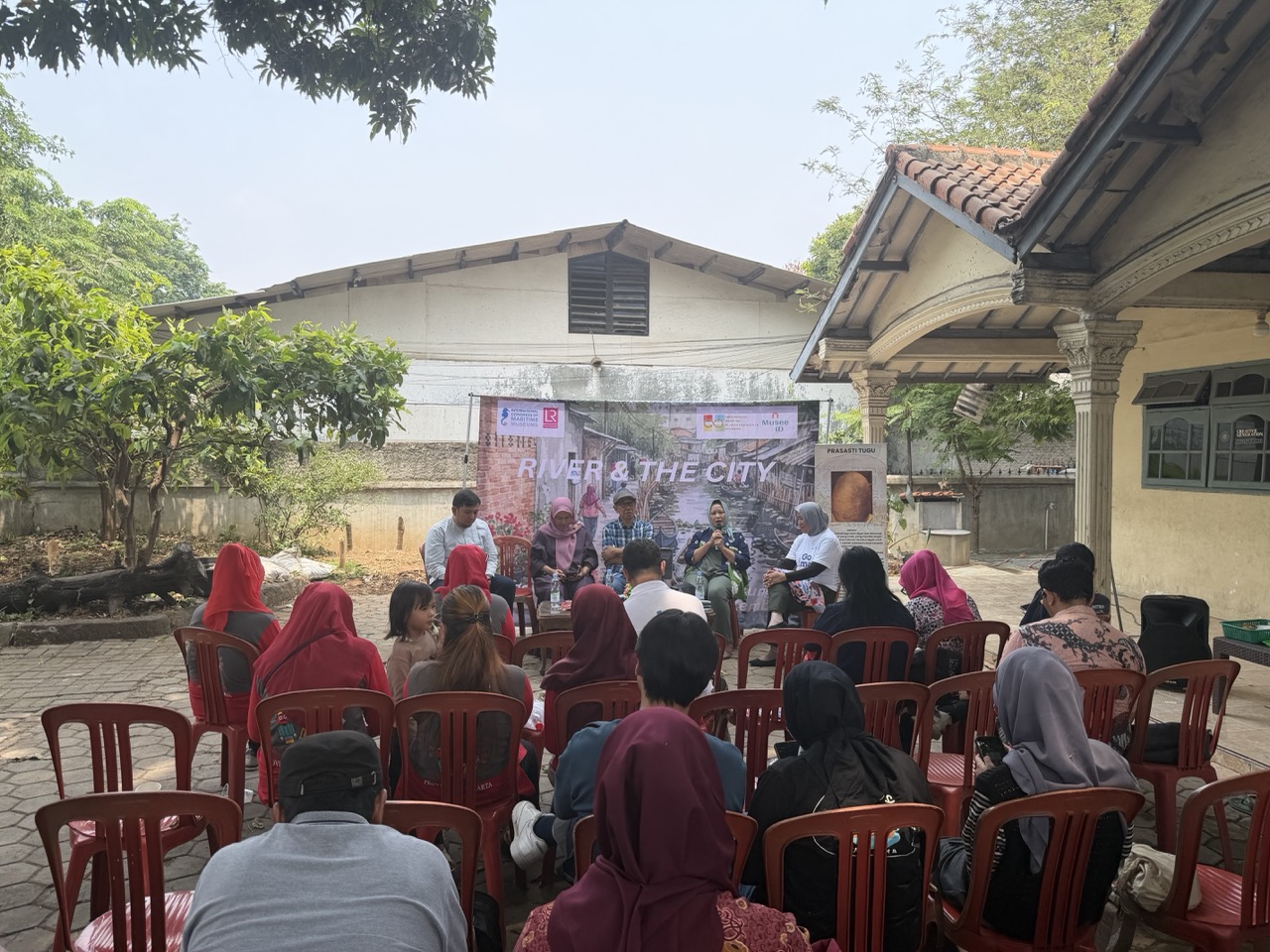
Residents were not invited simply as spectators. Families were encouraged to bring old photographs of community activities, relatives and the changing neighbourhood for scanning and documentation. Oral histories, private collections and lived memories are expected to complement archaeological evidence and government archives.
That approach places residents at the centre of interpretation. Following guidance from the International Council of Museums’ Committee for Education and Cultural Action, the heritage center is being developed through co-curation rather than through a narrative imposed entirely by outside institutions.
Connecting Heritage with Land Security
Recovering Batu Tumbuh’s history also requires sensitivity to present land ownership. Historical narratives, customary documents and family memories can help explain how a community developed, but they do not automatically establish a legal property title.
Land rights remain governed by Indonesia’s 1960 Basic Agrarian Law and subsequent registration regulations. Government Regulation No. 18 of 2021 provided a five-year period for written evidence of former customary ownership to be registered. Documents such as girik, Letter C and kekitir no longer operate as title certificates by themselves after that period.
The Ministry of Agrarian Affairs and Spatial Planning/National Land Agency has emphasized, however, that uncertified land is not automatically confiscated by the state. Older documents may still contribute to an evidentiary record, while physical occupation, boundaries, inheritance records and the absence or existence of competing claims must be verified through the appropriate land-registration process.
For Batu Tumbuh, separating cultural documentation from legal adjudication will be essential. A heritage center can preserve residents’ accounts of land and settlement, while the North Jakarta Land Office and other authorized institutions remain responsible for determining formal rights.
A Coastal Heritage Center for the Future
The proposed center is envisioned as more than a room displaying replicas and historical dates. Its planners see opportunities for public education, community-led walking routes, ecological interpretation, creative products and small-scale tourism connected to the waterways and living traditions of northern Jakarta.
Such development must keep residents involved and avoid turning heritage into a commercial attraction detached from the community. Integrating the area into regional development and spatial-planning documents could provide stronger protection while connecting cultural preservation with water management and environmental resilience.
“The sea must be our orientation; the sea is our future, and prosperity also lies at sea,” Susanto Zuhdi has said when discussing Indonesia’s maritime outlook. In Batu Tumbuh, that maritime perspective begins not only at the coastline but also along the rivers and channels that once sustained settlement.
The original Prasasti Tugu may now stand inside the National Museum, but its story belongs equally to the neighbourhood where it emerged from the ground. By combining scholarship, residents’ memories and responsible planning, Batu Tumbuh can transform a displaced stone into the foundation of a living heritage—one that helps Jakarta understand both its ancient relationship with water and its future beside the sea.


