New Zealand is an island nation located in the southwestern Pacific Ocean. The country has a total land area of 268,021 square kilometers.
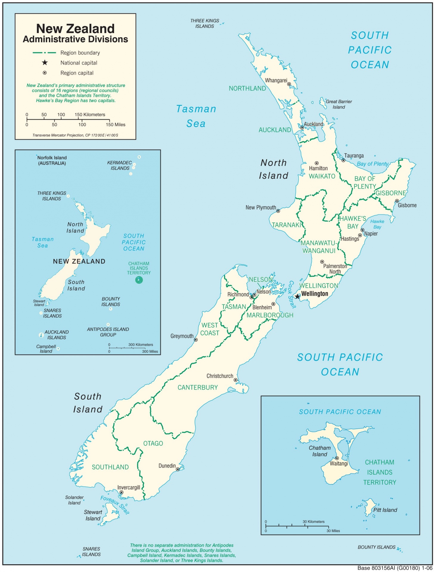
Administratively, the country is divided into 16 regions or regional councils. Five are located on the North Island, nine on the South Island, and two are unitary authorities.
The capital of New Zealand is Wellington, situated at the southern tip of the North Island. Meanwhile, Auckland is the largest city and main population center, which houses most of the country's population.
The Hidden Continent of Zealandia

New Zealand is not attached to the continent of Australia or the continent of Asia. The country stands on its own distinct continent named Zealandia.
Geologically, Zealandia was officially recognized as a separate continent through a scientific publication by the Geological Society of America in 2017. The findings of the publication show that the base of the continent lies at depths of 2,500 to 4,000 meters below sea level, with a continental crust thickness ranging between 10 and 30 kilometers.
The composition of the landmass is dominated by granite, rhyolite, greywacke, and schist. The rock characteristics and crustal thickness differ from the surrounding oceanic crust, which consists of basalt.
In addition, the total area of the continent of Zealandia spans approximately 4.9 million square kilometers. However, about 94 percent of the continent lies submerged beneath sea level.
The remaining area above sea level encompasses the territories of New Zealand and New Caledonia. Geologically, the entire land structure is separate from the Australian continent.
Geographical Division of New Zealand
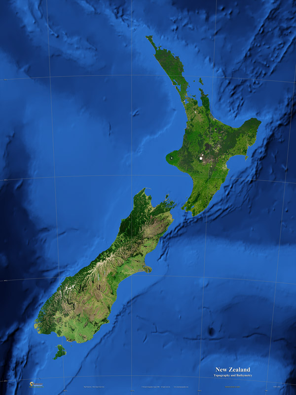
Geographically, New Zealand's landmass is divided into two main islands by the 22-kilometer-wide Cook Strait.
The North Island has a land area of approximately 113,729 square kilometers. The region is dominated by rolling hills, volcanic lakes such as Lake Taupo, and serves as home to the capital Wellington and the largest city Auckland.
The South Island has a larger land area of 150,437 square kilometers. The region is dominated by the Southern Alps range, extending from north to south with its highest peak, Mount Cook, reaching 3,724 meters.
Beyond the two main islands, the country includes a third-largest island named Stewart Island or Rakiura, covering 1,570 square kilometers to the south of the South Island. The nation also encompasses remote territories such as the Chatham Islands, located about 800 kilometers east of the South Island.
Both main islands and the outer islands rest upon the continental crust of Zealandia, which ranges from 10 to 30 kilometers in thickness beneath Earth's surface.
Maritime Geographic Boundaries
In terms of geographical boundaries, New Zealand is surrounded directly by seas and ocean waters on all sides.
To the west, New Zealand is separated from mainland Australia by the 2,000-kilometer-wide Tasman Sea. To the east, north, and south, its territory borders directly on the Pacific Ocean.
Maritimately, New Zealand manages an Exclusive Economic Zone (EEZ) covering 4.1 million square kilometers. The maritime area is approximately 15 times larger than its total land area.
Geologically, the country sits directly atop the boundary line of two major tectonic plates. The Pacific Plate lies to the east, while the Indo-Australian Plate lies to the west. The convergence line of the two plates runs directly through the North and South Islands.
Regional Geography of Oceania and Polynesia

In regional geography, New Zealand is grouped into the region of Oceania. The term was introduced by geographers in the 19th century to organize the scattered island territories across the Pacific Ocean.
The grouping connects New Zealand with the Pacific island chains through the subregion of Polynesia. The region of Polynesia forms a vast geographical expanse known as the Polynesian Triangle.
The imaginary expanse stretches from the Hawaiian Islands to the north to Rapa Nui to the east, before culminating at New Zealand at the southwestern corner.
Reference:
Mortimer, N., Campbell, H. J., Tulloch, A. J., King, P. R., Stagpoole, V. M., Wood, R. A., Rattenbury, M. S., Sutherland, R., Adams, C. J., Collot, J., & Seton, M. (2017). Zealandia: Earth’s hidden continent. GSA Today, 27(3), 27–35. https://doi.org/10.1130/GSATG321A.1