

Around 150 CE, a scholar in Alexandria recorded the name of an island called "Iabadiou" on the eastern edge of the known world. According to his account, the name meant "Barley Island," a place of exceptional fertility, rich in gold, with a capital city named "Argyre" or "Silver."
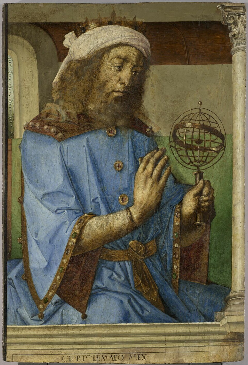
The scholar was Claudius Ptolemaeus, better known as Ptolemy. His work, Geographia, contains one of the oldest surviving references in Western literature to a place in the Indian Ocean bearing a name resembling "Java."

What makes the story particularly intriguing is that Ptolemy never sailed to the East. He spent almost his entire life in Alexandria, Egypt, compiling his maps from the accounts of others.
The island of Java that appeared on his map was therefore not the result of firsthand observation, but of information passed from one source to another across the seas.
The Geographer Who Mapped the World from His Desk
Ptolemy lived between approximately 100 and 170 CE and worked in Alexandria, a city that housed the largest library of its time and served as one of the principal hubs of trade between East and West.
This position gave him access to the two things every mapmaker needed: the writings of earlier scholars and the testimonies of merchants traveling across distant lands.
Rather than undertaking expeditions to chart faraway regions or gathering firsthand observations, Ptolemy worked as a compiler of knowledge. He combined information from earlier sources such as Marinus of Tyre, Roman travel records, and reports from merchants and travelers.
According to Britannica, Ptolemy himself acknowledged that he did not attempt to collect and evaluate all available geographical information. Instead, he based much of his work on that of Marinus of Tyre.
However, this method had a significant limitation. The locations of many places were reconstructed from descriptions such as, "After ten days of traveling north, we arrived at..." Ptolemy then estimated the distances by making assumptions about the terrain and the straightness of the routes taken.
The farther a region lay beyond the reach of the Roman world, the scarcer and less reliable the information available to him became. As a result, both the location and the shape of those places grew increasingly inaccurate on his maps.
And yes, Java lay at that very frontier, on the easternmost edge of the world as Ptolemy knew it.
A Vague Portrait of Java in the Historical Record
In Geographia, Iabadiou is described only briefly. Ptolemy wrote that its name meant "Barley Island," that it was fertile, rich in grain and gold, and that its capital was called Argyre, meaning "Silver" in Greek.
It is this reference to "barley" that has led some scholars to associate Iabadiou with the Sanskrit name Yavadvīpa, since yava means barley and dvīpa means island.
The problem is that the description is far too brief to determine with certainty which island Ptolemy was referring to. Historian Michael Laffan notes that Iabadiou was one of several place names Ptolemy compiled from travel accounts, and the name has attracted scholarly attention precisely because it is considered a possible reference to Yavadvīpa.
However, the name "Argyre" or "Silver" for its capital is difficult to treat as conclusive evidence. It resembles the legendary islands of "Silver" and "Gold" that appeared in Indian geographical descriptions in Pomponius Mela's De Chorographia, written in 43 CE.
Some of those names may even have referred to Sumatra rather than Java.
Ptolemy's Record, But Not His Map
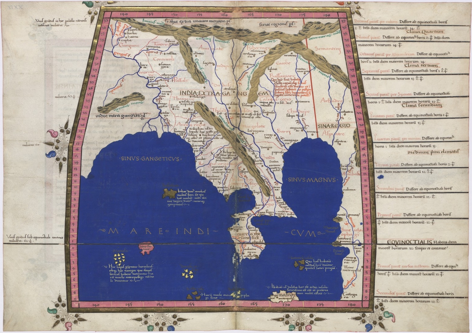
One aspect of the so-called "Ptolemy map" is often misunderstood. Ptolemy recorded the location of Java, but he did not actually draw the map that is commonly associated with his name.
What he left behind in Geographia was a lengthy list of instructions and coordinates for more than 8,000 place names, a numerical framework for constructing maps rather than illustrated map sheets.
Even this collection of coordinates disappeared for centuries. The text of Geographia survived only in much later manuscripts dating from the late thirteenth century and afterward, roughly a thousand years after the original work had been written.
The work was revived by Maximos Planudes, a thirteenth-century Byzantine polymath who is widely credited with rediscovering Geographia and producing a new edition of the text.
It was during this revival that the illustrated manuscripts we recognize today began to appear. One of the oldest surviving examples, Vatican Urbinas Graecus 82, was produced in Constantinople around 1300 and contains a world map along with 26 regional maps, including one of Asia.
This manuscript is closely associated with the cartographic tradition initiated by Planudes, although the hand-drawn maps he may have produced no longer survive and only his commentaries remain.
Exactly how these maps were created is still debated. Some scholars believe Planudes reconstructed them from the coordinates contained in Ptolemy's text.


