At 4,095.2 meters above sea level, Mount Kinabalu is the highest peak in Malaysia and the tallest mountain between the Himalayas and New Guinea. Its steep slopes and exposed summit have led many visitors to assume it is a volcano.
It is not.
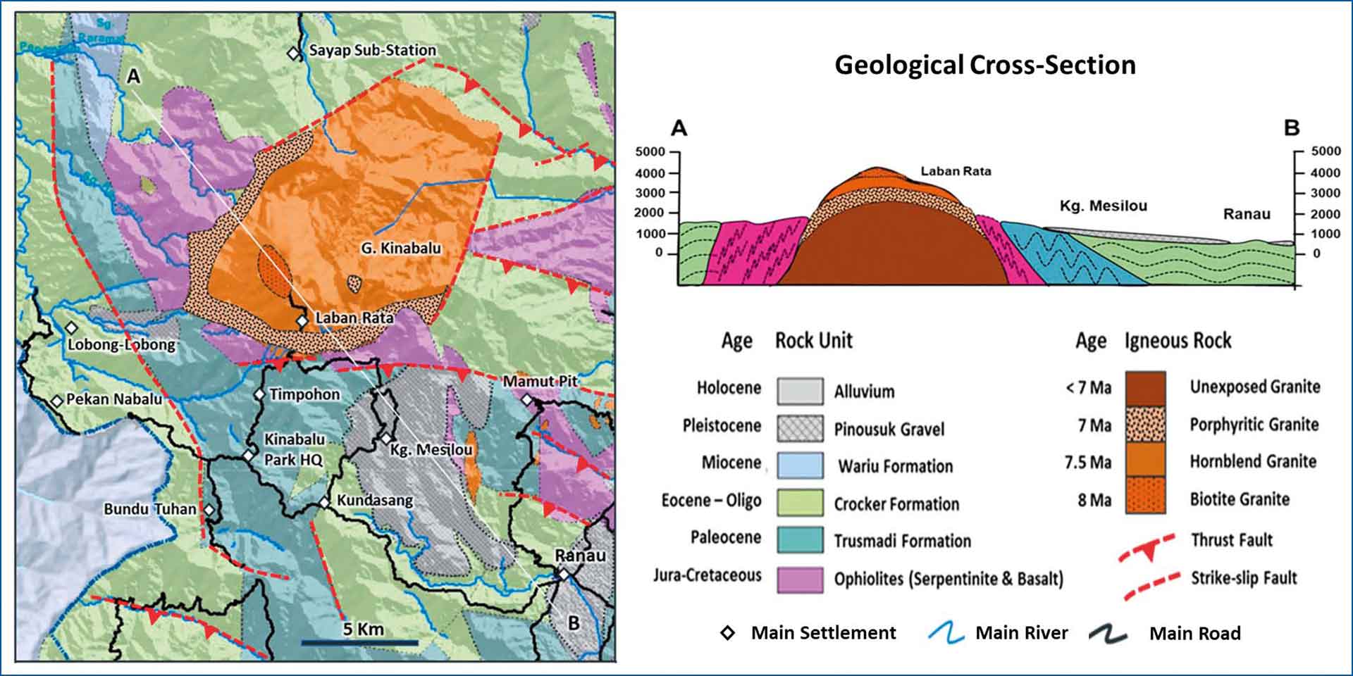
Despite its appearance, Mount Kinabalu has never been classified as a volcano. Instead, geologists identify it as a mountain formed by a massive granite intrusion that was later lifted by tectonic forces and exposed through millions of years of erosion.
A Mountain Built Underground
Volcanoes form when magma reaches Earth's surface as lava, ash, or volcanic debris. Mount Kinabalu followed a different geological path.
According to UNESCO and Sabah Parks, the mountain consists primarily of granitic rocks that crystallized from magma beneath the Earth's surface. Because the magma never erupted, it cooled slowly underground, forming a large body of intrusive igneous rock known as a pluton.
The Kinabalu UNESCO Global Geopark describes this granite body as the youngest granitoid intrusion in Southeast Asia, dating to about 7-8 million years ago.
Lifted by Tectonic Forces
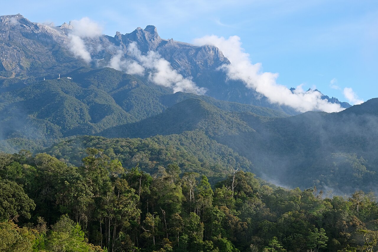
The granite that forms Mount Kinabalu did not become visible immediately after it solidified.
UNESCO states that the intrusion was later pushed upward by tectonic movements and continued to rise over time. As the surrounding rocks gradually eroded away, the harder granite core became exposed, creating the mountain seen today.
This process differs fundamentally from volcanic mountain building. Rather than accumulating layers of lava and ash from repeated eruptions, Mount Kinabalu emerged because rocks that had formed deep underground were uplifted and uncovered.
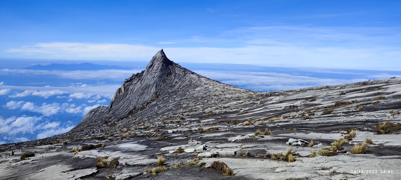
Evidence of this history remains visible near the summit, where large granite outcrops dominate the landscape instead of volcanic rocks such as basalt or andesite.
Why It Still Looks Like a Volcano
Although it is not volcanic, Mount Kinabalu shares several visual characteristics with volcanic peaks.
Its isolated position above the surrounding landscape, steep profile, and exposed rocky summit resemble the appearance of many stratovolcanoes across Southeast Asia. These similarities are largely the result of erosion rather than volcanic activity.
UNESCO notes that the summit landscape was also modified by glacial processes during the last Ice Age. Glacial erosion carved steep rock faces and distinctive granite formations that remain visible today.
A Geological Landmark in Southeast Asia
Mount Kinabalu's geological significance extends beyond its elevation.
In 2023, the surrounding region was designated the Kinabalu UNESCO Global Geopark. UNESCO highlighted the area for containing the youngest granitoid intrusion in Southeast Asia together with ancient oceanic crust dating back about 130 million years, providing an exceptional record of the region's tectonic history.
The mountain also anchors Kinabalu Park, Malaysia's first UNESCO World Heritage Site. Besides its geological importance, the park supports exceptional biodiversity across elevations ranging from tropical rainforest to alpine shrublands. UNESCO notes that more than 90% of the park remains covered by natural vegetation.
Mount Kinabalu's towering profile may resemble a volcano, but its origin tells a different story. Instead of erupting from the Earth's surface, it began as magma that cooled underground before tectonic forces gradually lifted it into one of Southeast Asia's most recognizable mountains.