


Before sunrise on August 15, a magnitude-7.7 earthquake struck offshore Flores in Indonesia’s East Nusa Tenggara province. The tremor triggered a tsunami reaching 1.6 metres in parts of the region and began a prolonged sequence of thousands of aftershocks.
By August 25, authorities had confirmed 103 deaths and 1,666 injuries. More than 73,000 homes were damaged and approximately 180,000 people evacuated, turning the disaster into a regional test of warning systems, construction standards and emergency coordination.
Two Fault Zones, One Regional Warning
Indonesia’s Meteorology, Climatology and Geophysics Agency issued its first tsunami warning two minutes and 16 seconds after the Flores earthquake. Waves were detected at 16 locations across four provinces, while more than 4,200 aftershocks had been recorded by August 21.
The Philippines faced a parallel reminder of its seismic exposure. On August 5, a shallow offshore earthquake near Sarangani registered magnitude 6.3 with the United States Geological Survey and 6.4 with the Philippine Institute of Volcanology and Seismology. Although it was not expected to cause major damage, it followed the destructive magnitude-7.8 Mindanao earthquake in June and several strong subsequent tremors.
Both countries lie along complex plate boundaries within the Pacific Ring of Fire. Earthquakes cannot be prevented, but their human consequences can be reduced through decisions made long before the ground begins moving.
Fifteen Years of Seismic Lessons
Southeast Asia’s recent history shows that magnitude alone does not determine the scale of a disaster. Building quality, population density, soil conditions and emergency readiness can be equally decisive.
The magnitude-7.2 Bohol earthquake in the Philippines killed 222 people in 2013. In 2018, the Central Sulawesi earthquake, tsunami and liquefaction disaster claimed 4,340 lives, with another 667 people declared missing. Four years later, a smaller but shallow magnitude-5.6 earthquake in Cianjur killed 602 people according to the district government and temporarily displaced more than 114,000.
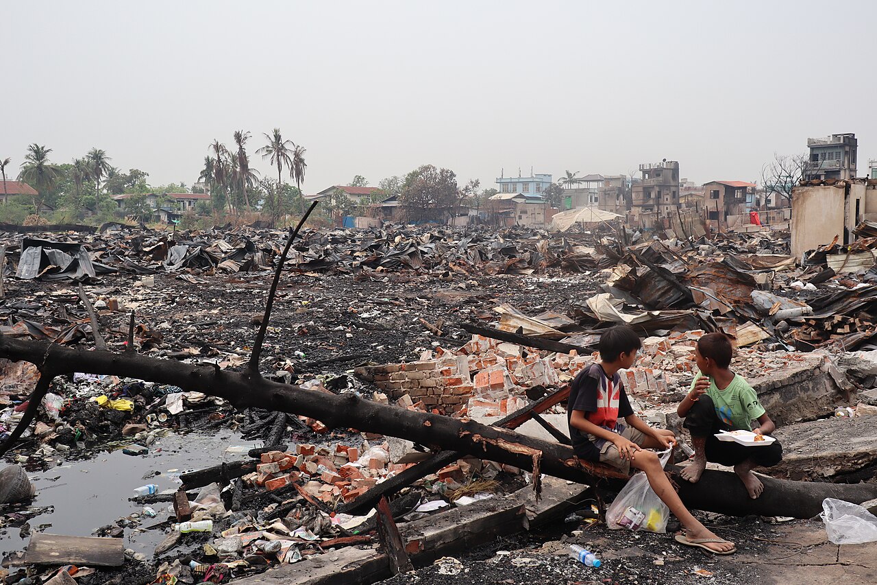
In March 2025, the magnitude-7.7 Mandalay earthquake in Myanmar left 3,731 people dead and more than 5,100 injured by late May. Estimated economic losses reached US$1.8 billion. Together, these disasters underline a recurring lesson: vulnerable buildings transform geological hazards into human catastrophes.
Safer Buildings Begin Before the Ground Moves
Flores brought that vulnerability into sharp focus. BNPB reported damage to 1,378 schools, affecting more than 177,000 students and 21,000 teachers and education personnel. Hospitals, roads, government buildings and places of worship were also affected.
Building codes therefore need to be enforced as operating standards rather than treated as administrative requirements. Schools, hospitals, apartments and transport terminals should be audited and retrofitted, particularly in areas exposed to active faults, liquefaction, landslides or tsunamis.
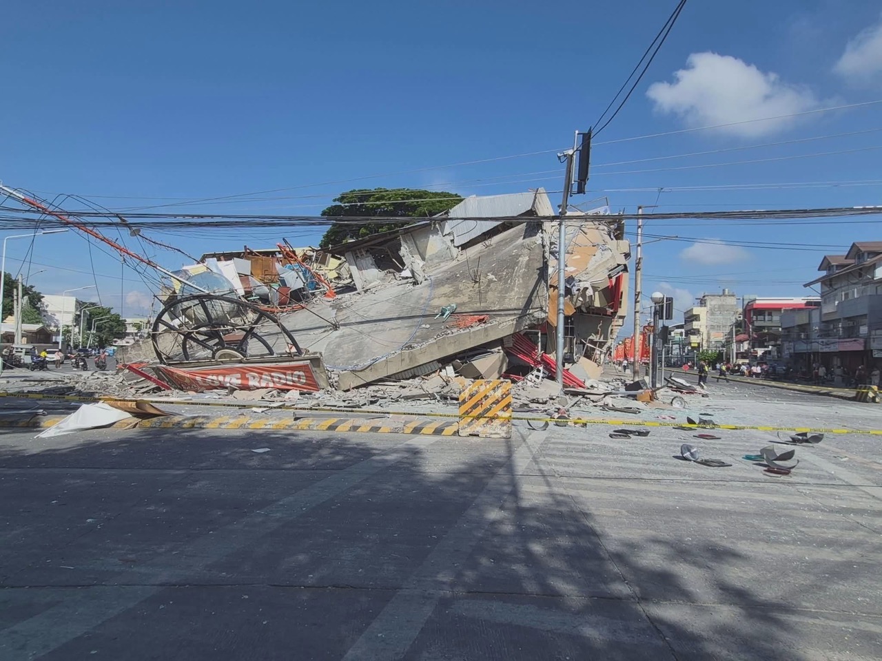
Microzonation can identify neighbourhoods where soft ground may amplify shaking. Following the Flores earthquake, BMKG deployed teams to study ground response, monitor aftershocks and support safer reconstruction planning.
Preparedness must also become routine at community level. “Preparedness is still a key. Do the duck, cover and hold when there are strong earthquakes,” PHIVOLCS Director Teresito Bacolcol has advised. Regular school and neighbourhood drills can prevent panic, while clearly marked evacuation routes are essential for coastal communities that may have only minutes to reach higher ground.
Local Response, Regional Reach
The first hours after an earthquake belong to local communities. Neighbours, health workers, firefighters, search-and-rescue personnel and volunteers often reach survivors before national or international assistance arrives.
In Flores, Indonesian agencies used helicopters, trucks and motorcycles to deliver relief across difficult terrain. President Prabowo Subianto said the government wanted to ensure that affected communities received “prompt and comprehensive emergency assistance.”
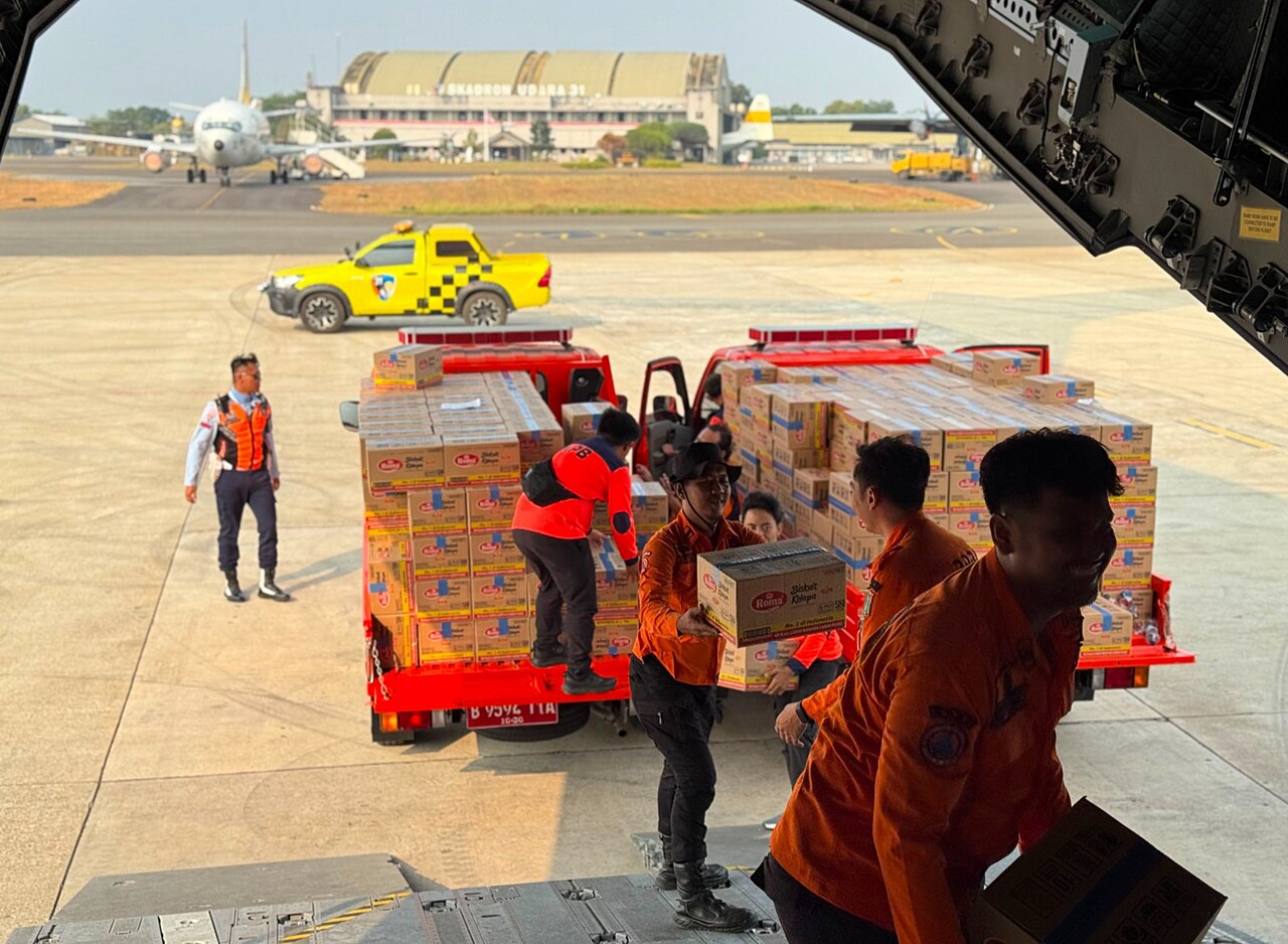
National capacity is reinforced by ASEAN’s regional architecture. Through the AHA Centre, member states can mobilise trained assessment teams and relief supplies under the One ASEAN, One Response framework. The Disaster Emergency Logistics System for ASEAN maintains stockpiles in Subang, Malaysia, and satellite warehouses in the Philippines and Thailand.
By the end of 2024, the ASEAN Emergency Response and Assessment Team network included 422 trained responders. These mechanisms do not replace domestic leadership, but they can accelerate logistics, information management and humanitarian support when national resources become stretched.
As AHA Centre Executive Director Lee Yam Ming said, “Together, we will continue to rise through every moment, stronger, smarter and more united.”
Financing a Safer Recovery
Recovery must extend beyond replacing what was destroyed. Public reconstruction funds should require improved seismic design, safer locations and independent building inspections. Otherwise, communities risk rebuilding the same vulnerabilities.
Parametric insurance, already tested in the Philippines, can release funding automatically when an earthquake reaches an agreed threshold. Emergency credit and carefully structured low-interest financing can also help farmers, traders and small businesses reopen without falling into long-term debt.
For Southeast Asia, the next advance in earthquake resilience will not come from predicting an exact time or location. It will come from stronger buildings, informed communities, protected livelihoods and regional systems ready to act.
Flores and Mindanao have delivered another warning. The region’s responsibility is to ensure that when the ground moves again, survival depends less on chance, income or postcode—and more on preparation built into everyday life.


