Ranu Kumbolo is a natural freshwater lake located on the Mount Semeru hiking trail. The mountain waters lie within the administrative region of Lumajang Regency in East Java Province.
The lake basin sits at an elevation of around 2,400 meters above sea level. The surrounding hill contours form a wide valley that holds water in the middle section of the hiking trail.
A Water Basin in the Middle of the Semeru Valley
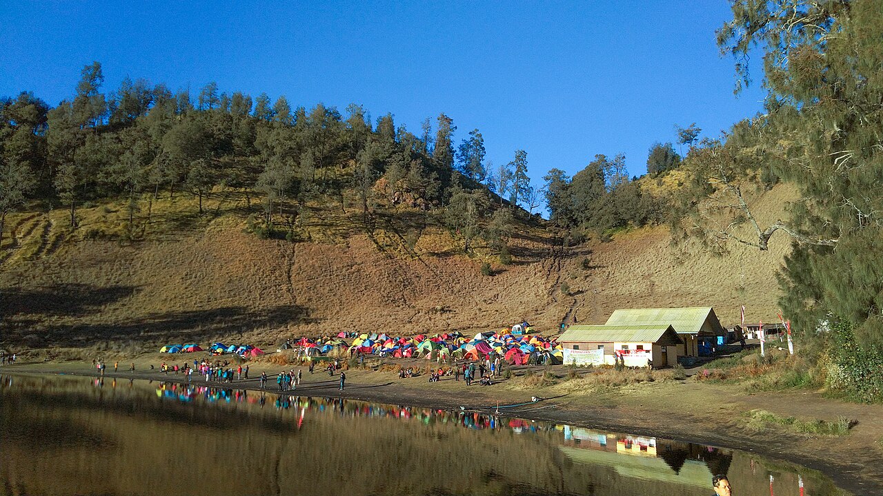
The surface area of Ranu Kumbolo reaches about 15 hectares with an elongated shape following the valley contours. Its freshwater supply comes from rainfall and spring flows from the surrounding hill slopes.
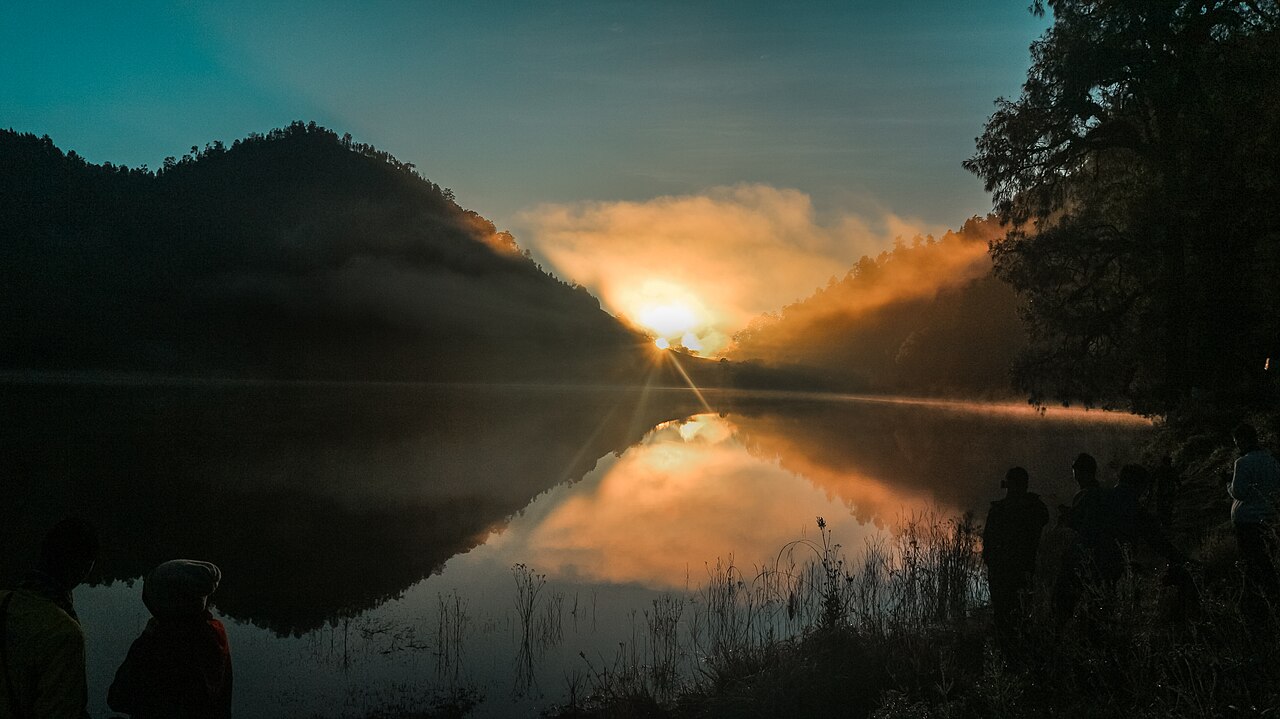
On the eastern side of the lake, two green hills stand side by side, forming a valley gap. The gap between the two hills serves as the point where morning sunlight emerges onto the water surface.
Meanwhile, on the western side, ascending hill slopes form the boundary of the valley basin edge. The ground contour on the northern shore tends to be flatter and more open compared to the other sides.
On the northern shore area, a permanent shelter building also stands, functioning as a resting point and an emergency refuge. The surfaces of the hill slopes surrounding the lake are covered with rows of mountain casuarina trees and expanses of grassland.
Air temperatures in the lake valley area range from 10 to 15 degrees Celsius during the day. When the peak of the dry season arrives, nighttime air temperatures can drop below zero degrees Celsius, creating a layer of frost on the grass surface.
Location of Ranu Kumbolo in the Semeru Conservation Area
Administratively, Ranu Kumbolo falls within the territory of Ranu Pani Village, Senduro District, inside the management zone of Bromo Tengger Semeru National Park. The waters and the surrounding hills hold the status of a nature conservation area protected by the state.
Land access to the lake shore is reached on foot via a footpath from Ranu Pani Village. The approximately 10.5-kilometer route passes through four checkpoint posts, including Landengan Dowo and Watu Rejeng, before arriving at the northern shore of the waters.
The status as a nature conservation area is accompanied by activity restrictions in the waters of Ranu Kumbolo. Swimming and washing eating utensils directly in the lake water are prohibited.
History of Trail Closures to Ranu Kumbolo
Aside from activity restrictions in the waters, access to Ranu Kumbolo is not always open year-round. The lake area was completely closed to all visitation activities starting December 4, 2021, following a major eruption of Mount Semeru.
The trail closure lasted for about three years during the period of volcanic activity monitoring and ecosystem recovery. The route from Ranu Pani Village to the lake shore only reopened on December 23, 2024, with the destination limited solely to Ranu Kumbolo without further access to the mountain summit.
The hiking trail to Ranu Kumbolo was completely closed again in August 2026 due to a forest fire in the national park area. The trail closure caused by the forest fire was enforced until an undetermined time.
When the trail is open, a daily quota is applied through an online registration system for every passing group, along with mandatory use of official guides. Inspections of belongings that have the potential to produce waste are also enforced at the Ranu Pani gate post before and after the trip.