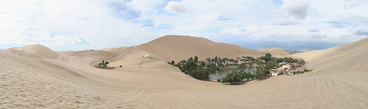
In Peru, there is a village at a desert oasis named Huacachina in the coastal area of the Ica Region. Huacachina is located in the southwestern part of Peru. The village lies approximately five kilometers west of downtown Ica.
The main feature of Huacachina is a lagoon basin in the middle of sand dune formations. The water basin has an oval shape.
Rows of sand dunes around the basin rise tens of meters above the lake's surface. The sand mounds surround the entire basin area.
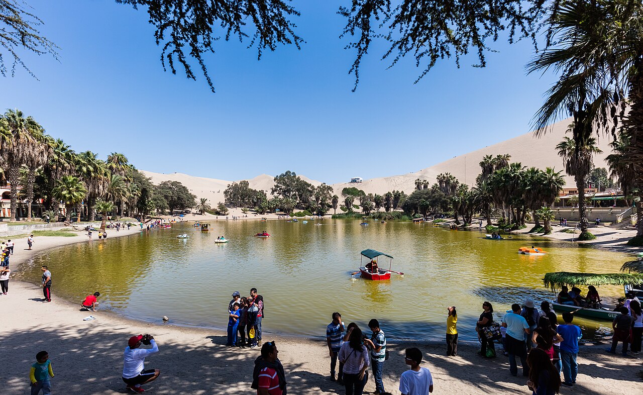
A pedestrian walkway along with rows of local houses stands on the edge of the lagoon. Several lodgings also encircle the shoreline.
The Water Source Forming the Lagoon in the Desert
The water filling the Huacachina Lagoon comes from the flow of the Ica Valley aquifer. The underground water-bearing layer receives its primary supply from the Andes Mountains.
The lagoon formed in a low basin between sand dunes where the shallow groundwater table reaches the surface. Geological conditions at the bottom of the basin allow the groundwater to seep out.
Water seepage from the aquifer filled the bottom of the basin over time. The groundwater supply initially formed a body of water that lasted throughout the year.
Shallow groundwater also supports the growth of native desert trees such as huarango in the sandy area around the basin. The tree species has long roots that reach water reserves beneath the sand.
Meanwhile, the rows of palm trees along the edge of the lagoon are not native desert plants. Local people planted the palm trees when the settlement area began to be developed.
How the Water of Huacachina Lagoon Is Kept Filled
Dry coastal desert temperatures cause high evaporation rates on the surface of the Huacachina Lagoon throughout the year. The evaporation reduces the lake's water volume continuously.
Well drilling for agricultural land in the Ica Valley lowered the groundwater table from the 1960s to the 1970s. Depletion of underground water reserves prevented seepage from the aquifer from routinely reaching the basin floor since the 1980s.
Reduced aquifer seepage meant the groundwater supply could no longer replace the evaporated water. The water level of the Huacachina Lagoon consequently dropped continuously.
To maintain the lake's water level, the Provincial Government of Ica together with local businesses implemented periodic artificial pumping. Pump installations channel water from underground sources into the lagoon basin.
In 2015, the Regional Government of Ica carried out a water replenishment program for the lagoon. The government channeled water from boreholes around the Ica Valley through a pipeline network to stabilize the lake's depth.
History of the Settlement Formation on the Lagoon Edge
People around the Ica Valley visited the lagoon area long before permanent buildings stood. Local people used the mineral content in the water and bottom mud, which was believed to relieve skin disorders and joint pain.
The development of Huacachina as a bathing site began in the early 20th century. The construction of a connecting road from downtown Ica along with the establishment of bathing facilities and resting areas also took place during the period.
The Huacachina bathing area was later widely used by people from various regions of Peru in the 1940s to 1950s. Many people from outside Ica came to the lakeside to undergo mineral water and mud bath therapy.
As the bathing facilities expanded, rows of lodgings and local houses continued to be built around the water. The growth of village buildings remained confined to a narrow strip between the lagoon edge and the foot of the sand dunes.
Today, the buildings on the lagoon edge still function as homes and lodgings.