


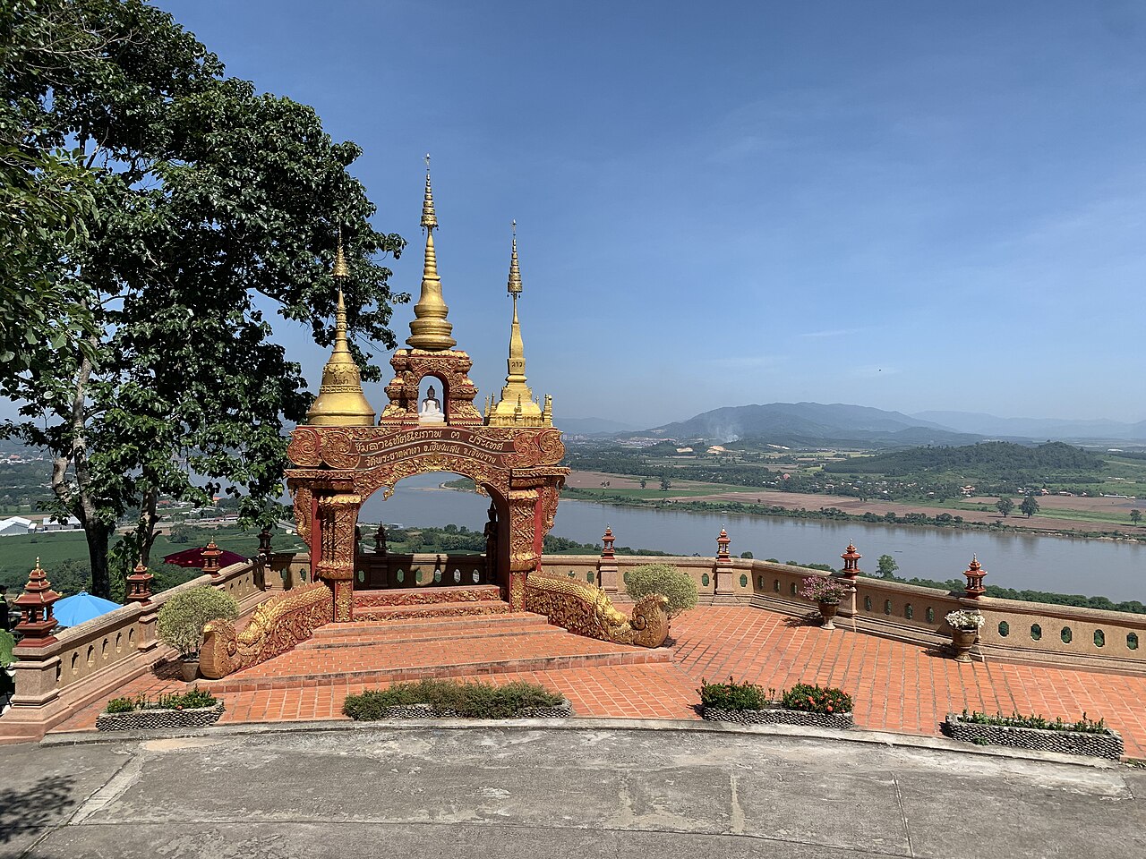
In Sop Ruak, northern Thailand, tourists often stand on the banks of the Mekong River, taking photos of a single point across the water: where Thailand, Laos, and Myanmar meet. This meeting point of three countries is known around the world as the Golden Triangle. The name was only coined in 1971 by U.S. officials, as the mountainous region had long been one of the world's largest centers of opium production.
But at the meeting point itself, what appears is something neat on a map: straight lines, three colors, and a single point where the Mekong and Ruak rivers meet. A line that neat, however, came from a process that was anything but. It was shaped by territorial competition between two colonial powers, along with a river that, to this day, refuses to stay in one place.
A Territorial Dispute That Ended at the Colonial Negotiating Table
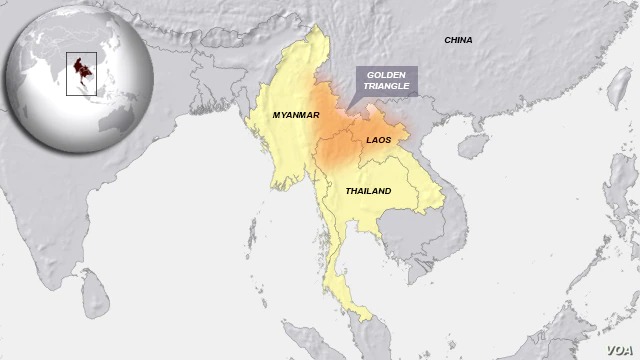
The Golden Triangle's borders were not the result of an agreement among Thailand, Laos, and Myanmar themselves. They are a legacy of France and Britain, two colonial powers that were expanding their territories from opposite directions.
France advanced from Viet Nam and Cambodia, while Britain moved in from Burma. Siam, now Thailand, was caught between the two.
The turning point came on July 13, 1893, in what later became known as the Paknam Incident. Two French warships entered the mouth of the Chao Phraya River despite an explicit ban from the Siamese government. They exchanged fire with Siamese defenses on land and water, then continued sailing toward Bangkok and pointed their guns toward the Royal Palace.
Siam suffered a decisive defeat. France forced Siam to surrender all territories east of the Mekong River, including Laos, while establishing the river as the main boundary between Siam and the French colonies.
Three years later, on January 15, 1896, Britain and France sat down together. Through the Anglo-French Convention, they agreed that the Mekong would also serve as the boundary between British Burma and French Laos.
The rule was that the boundary would follow the thalweg, the technical term for the deepest channel of a river, from its meeting point with China in the north to its meeting point with Thailand in the south, precisely at Sop Ruak. The remaining sections of the border were finalized through subsequent Franco-Siamese treaties in 1904 and 1907, including territorial exchanges on the other side of the Indochinese Peninsula.
All of this was negotiated and mapped by colonial officials pursuing their own interests, based on field surveys that, in broad terms, amounted to little more than “follow the river.” For colonial territories spanning such vast areas, this was considered sufficiently precise at the time.
The problem only became apparent later: a river is not a line that stays in one place.
The River That Refuses to Stay Still
The thalweg rule agreed upon in the 1896 Convention sounds simple and precise: the national boundary follows the river's deepest channel, wherever that channel shifts. But the negotiators themselves knew the rule could not be applied so literally.
They therefore added one exception: when an island sits in the middle of the river, the rule changes.
This small exception became a major source of disputes a century later. Along the Laos-Thailand border alone, the Mekong has long had more than a hundred small islands. For nearly a century, these islands have remained contested: who owns each island, and therefore where exactly should the national boundary be drawn?
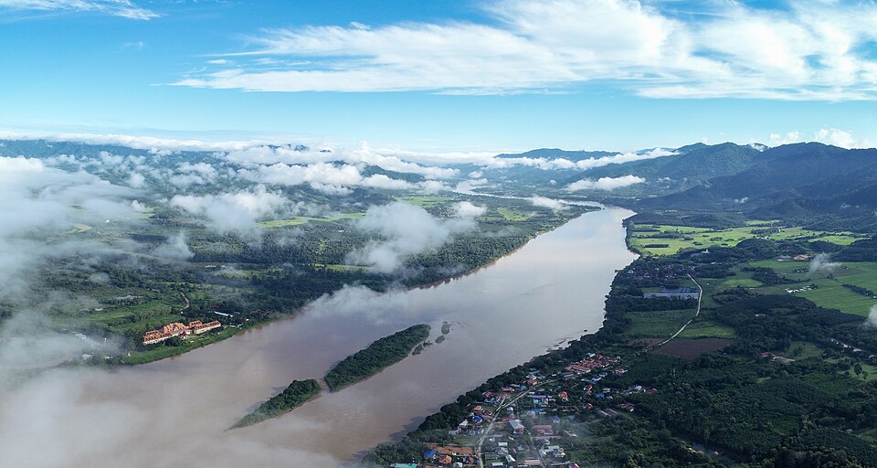
On top of these longstanding disputes came a new problem: the river itself kept changing shape. Upstream dams in China regulate water releases in ways that have drastically altered the Mekong's sediment flow.
As a result, more than 20 new sandbars, entirely different from the hundreds of older islands, have appeared in the middle of the river in just the past few years. These new formations did not exist when the border treaties were signed more than a century ago. Their emergence has triggered new debates between Lao and Thai villagers over who has the right to graze livestock or fish there.
These changes are not merely numbers on paper. Around Chiang Saen, a 14th-century city located just a few kilometers from Sop Ruak, local residents can see for themselves how the river, which once flowed through one area, has now shifted far away, leaving its former channel behind as dry land.
Satellite imagery confirms what local residents have long observed: the Mekong does not simply erode one bank and deposit sediment on another little by little. At times, it cuts an entirely new channel and abandons its old one.
A Legacy That Still Requires Renegotiation
The boundary marker at Sop Ruak that serves as a backdrop for tourists' photos today actually stands on top of a border-demarcation process that has never been fully settled, even after more than a century.
As long as the Mekong continues to erode one bank and deposit sediment along another, and upstream dams continue to alter its flow patterns, the lines hastily drawn by colonial diplomats in the late 19th century will continue to require renegotiation.
The process may continue island by island and sandbar by sandbar, long after the colonial powers that drew those lines have disappeared.


