


Deep beneath the surface of the Indian Ocean, stretching from northern Sumatra to southern Java and onward to the Lesser Sunda Islands, lies a vast trench known as the Sunda Trench (also known as the Java Trench).
It extends for around 3,200 kilometers, with its deepest point reaching 7,192 meters below sea level. This depth comes from the most precise direct measurement ever conducted, made during the Five Deeps Expedition in 2019 using a crewed submersible.
This makes the Sunda Trench the deepest point ever recorded in the Indian Ocean, deeper than points such as the Dordrecht Deep in the Diamantina Fracture Zone, which was previously considered the deepest point.
But the Sunda Trench is not only about its depth. Along the trench, tectonic plates continue to move, producing tremors and earthquakes that are felt from time to time by millions of people around the Indian Ocean.
Two Plates That Keep Moving
Earth’s surface consists of tectonic plates that move slowly, only a few centimeters each year. Around the Sunda Trench, the Indo-Australian Plate from the south meets the Sunda Plate, part of the Eurasian Plate, to the north.
Because the Indo-Australian Plate is denser, it gradually moves beneath the Sunda Plate. This process is known as subduction.
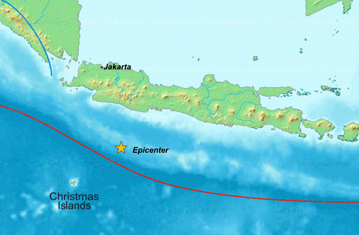
Its rate varies along the trench, from less than 2 centimeters per year near the Andaman and Nicobar Islands to 5 to 7 centimeters per year near Sumatra and Java. That is roughly the speed at which human fingernails grow.
This movement forms the deep trench on the seafloor as well as the chain of volcanoes across Sumatra and Java. But the two plates do not always move smoothly where they meet.
When Plates Lock, Earthquakes Follow
Friction between the two plates can cause them to become locked together for decades or even centuries. As both plates continue to move, energy keeps building up.
When that locked section finally breaks free, the stored energy is released within seconds, producing an earthquake. Because the boundary between the two plates lies beneath the ocean, a sudden shift in the seafloor can also displace large amounts of water and trigger a tsunami.
A History of Major Earthquakes
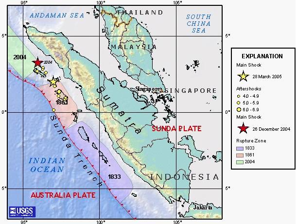
The Sunda Trench has a long history of powerful earthquakes. On December 26, 2004, a roughly 1,300-kilometer section of the northern trench ruptured. The resulting earthquake reached a magnitude of 9.1 to 9.3, making it one of the largest earthquakes ever recorded.
The seafloor shifted by more than 20 meters within minutes. This displacement triggered a tsunami with waves reaching up to 35 meters that struck Aceh and killed more than 200,000 people across the Indian Ocean region.
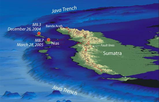
Three months later, on March 28, 2005, a segment near Nias Island ruptured. The magnitude 8.6 earthquake killed more than 1,000 people. Scientists linked the event to changes in pressure on neighboring segments following the 2004 earthquake.
The Java earthquake in 2006 and the Bengkulu earthquake in 2007 followed. Together, these events marked one of the most active periods of megathrust earthquake activity in the modern record.
The Sections That Have Yet to Rupture
Several sections of the Sunda Trench have experienced major earthquakes in recent decades. Scientists have therefore also turned their attention to sections that have not experienced a major rupture for a long time.
One of them is the Mentawai-Siberut segment, off the coast of West Sumatra. This segment last experienced major ruptures in 1797 and 1833.
Since the significant earthquake in 2000, the area has shown relatively little movement. This condition is known as a seismic gap, in which tectonic energy continues to build up without being released through a major earthquake.
Scientific modeling shows that the Mentawai-Siberut segment could potentially generate an earthquake of up to magnitude 8.9. At a disaster workshop held at Andalas University in Padang on September 27, 2025, experts identified Mentawai-Siberut and the Sunda Strait as the two highest-risk megathrust zones among Indonesia’s 12 megathrust segments.
A Trench That Never Truly Stands Still
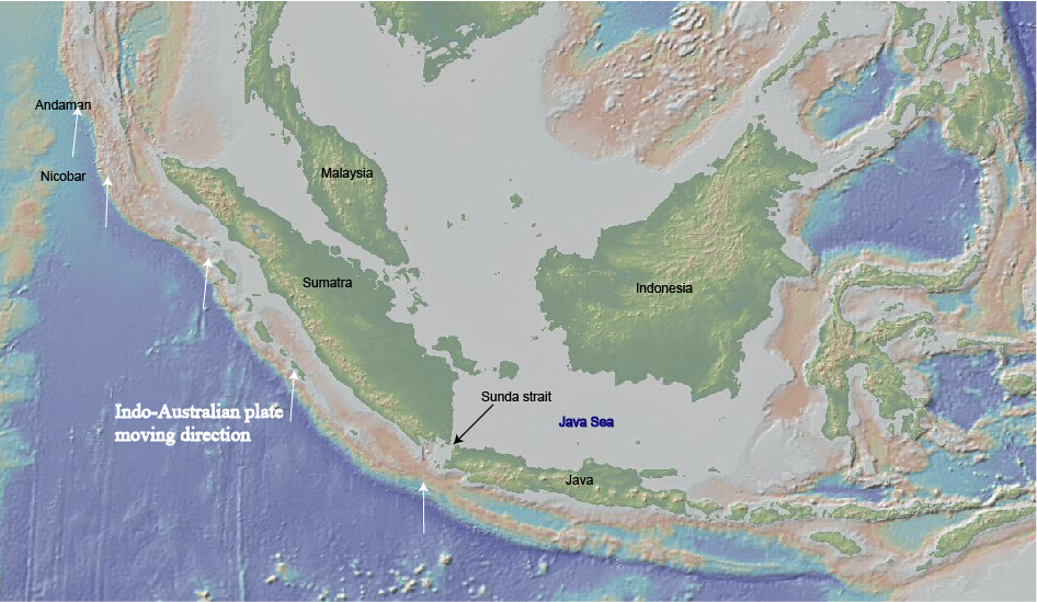
The activity of the Sunda Trench remains visible today. On February 6, 2026, an earthquake with a thrust-fault mechanism associated with subduction activity struck Pacitan, East Java.
Different agencies recorded different magnitudes, with an initial calculation of 5.8 and a magnitude of 6.2 recorded by the Meteorology, Climatology, and Geophysical Agency (BMKG). The earthquake killed one person and injured 47 others.
Following the 2004 disaster, Indonesia established the Indonesian Tsunami Early Warning System (InaTEWS). The system uses earthquake sensors, GPS, tide gauges, and monitoring centers in Jakarta and Denpasar that operate around the clock to detect potential tsunamis and issue early warnings.
As long as the Indo-Australian Plate continues to move beneath the Sunda Plate, this process will continue. The Sunda Trench has been moving and releasing energy for millions of years, from small tremors that are barely felt to major earthquakes capable of changing the lives of millions of people.


