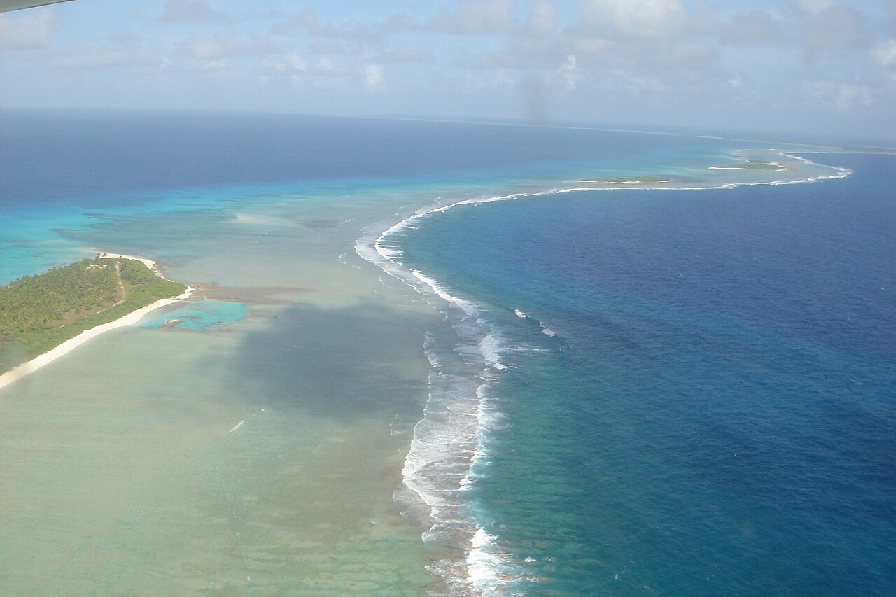
The Marshall Islands may be better known today for their low-lying atolls, turquoise lagoons, and vulnerability to rising sea levels.
Tucked away in the central Pacific, the islands sit roughly 3,500 km from Indonesia, the nearest Southeast Asian country, about 3,700 km from Australia, and over 7,500 km from the U.S. mainland. But decades ago, this remote Pacific island nation became one of the most important nuclear testing grounds in U.S. history.
Between 1946 and 1958, the United States conducted 67 atmospheric nuclear weapons tests in the Marshall Islands, primarily around Bikini and Enewetak atolls, according to the U.S. Department of State.
The tests were part of a much larger American effort to develop and understand nuclear weapons during the early Cold War.
Before The Americans Arrived
Long before the U.S. ever set foot on the atolls, the Marshall Islands had already passed through the hands of several foreign powers.
The islands were settled by Micronesian navigators around 3,000 years ago. Marshallese navigators used stars, ocean swells and currents to travel between atolls, with traditional stick charts representing the movement of waves across the sea, according to the Smithsonian Institution.
Germany established a protectorate over the Marshalls in 1885, setting up trading stations on Jaluit and Ebon to support the copra trade while local high chiefs continued to rule under indirect German administration.
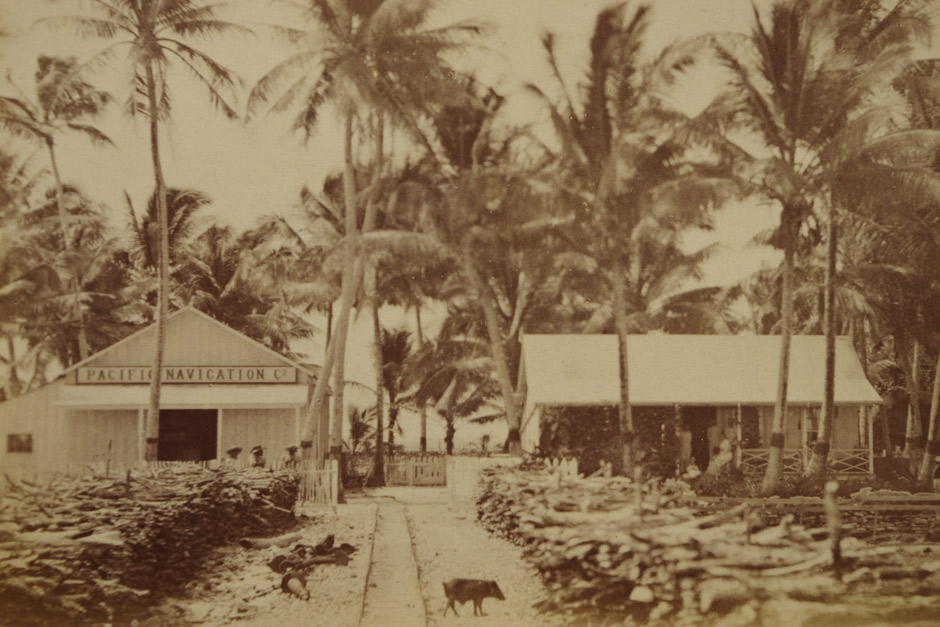
Japan then seized the islands in 1914 and later expanded its military presence, developing Kwajalein and several other atolls into military bases.
Japanese rule ended when U.S. forces captured key parts of the islands in 1944. By 1947, the Marshalls became a U.S. administered UN Trust Territory, according to the U.S. National Archives. Two years later, the first mushroom cloud rose over Bikini Atoll.
Why the Marshall Islands?
Their remote location in the central Pacific offered the United States vast areas of ocean for weapons testing, while the islands themselves had relatively small populations.
The first nuclear test there took place at Bikini Atoll in 1946, under Operation Crossroads, a series designed to study how nuclear weapons would affect naval warships.

The first shot, dropped by a B-29 bomber, actually missed its target fleet by more than 450 meters, but the second shot, detonated underwater weeks later, sent a massive column of water into the air, vaporizing one ship and sinking or capsizing eight others.
From 1948, testing shifted largely to nearby Enewetak Atoll. In 1952, it hosted Ivy Mike, the first full scale thermonuclear test, according to the U.S. Department of Energy. Testing later returned to Bikini, including the 1954 Castle Bravo test, before the U.S. program in the Marshall Islands ended in 1958.
But the testing came at a cost for the people living there.
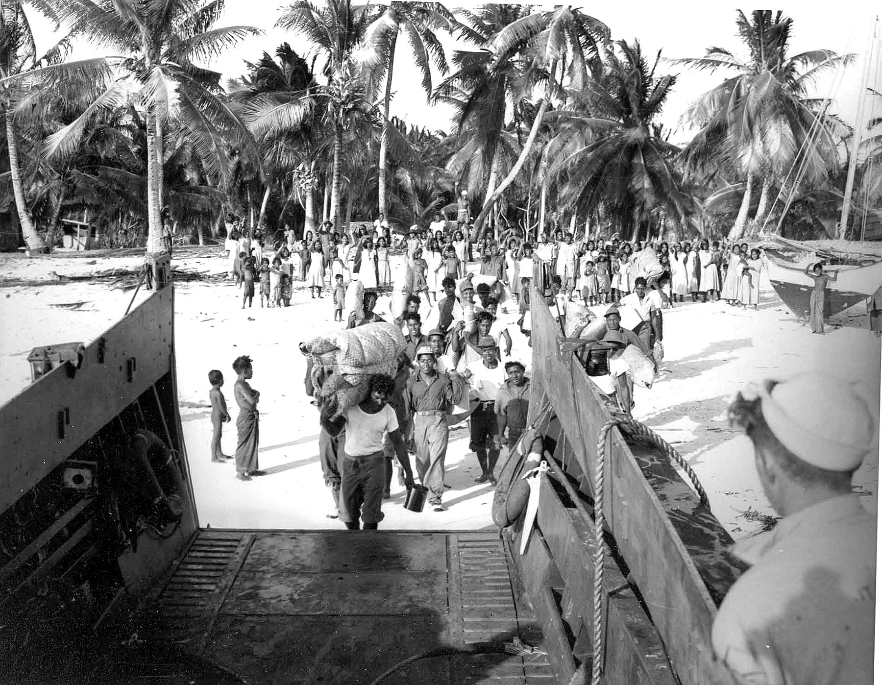
Before Operation Crossroads, 165 residents of Bikini Atoll agreed to leave their homes and were relocated to Rongerik Atoll, according to the U.S. Navy. Rongerik could not provide enough food for the community, and many eventually faced starvation. They were later moved to Kwajalein before settling primarily on Kili Island.
Castle Bravo Test
The most infamous test was Castle Bravo, detonated at Bikini Atoll on March 1, 1954.
The hydrogen bomb was expected to produce about 6 megatons of explosive power. Instead, it produced approximately 15 megatons, making it the largest nuclear weapon ever detonated by the United States.
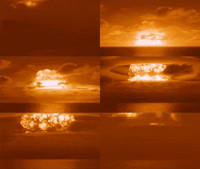
The blast was roughly 1,000 times more powerful than the atomic bomb dropped on Hiroshima, according to the National Security Archive. The unexpectedly powerful explosion also produced a much larger radioactive fallout area than anticipated, spreading radioactive debris over more than 18,000 square kilometers.
Radioactive material reached inhabited atolls including Rongelap, Rongerik, and Utrik, forcing emergency evacuations. The U.S. government later established a special medical program for people from Rongelap and Utrik who were exposed to radiation from Castle Bravo.
The Nuclear Legacy Is Still There
Decades later, the physical scars of the testing program are still being managed.
At Enewetak Atoll, the United States later built the Cactus Crater Containment Structure, commonly known as the Runit Dome, to contain radioactive soil and debris collected during the cleanup of the atoll, according to the U.S. Department of Energy.
The structure was built between 1978 and 1980 over a crater created by a 1958 nuclear test. It is roughly 7.3 meters high and contains more than 100,000 cubic yards of contaminated soil and debris.
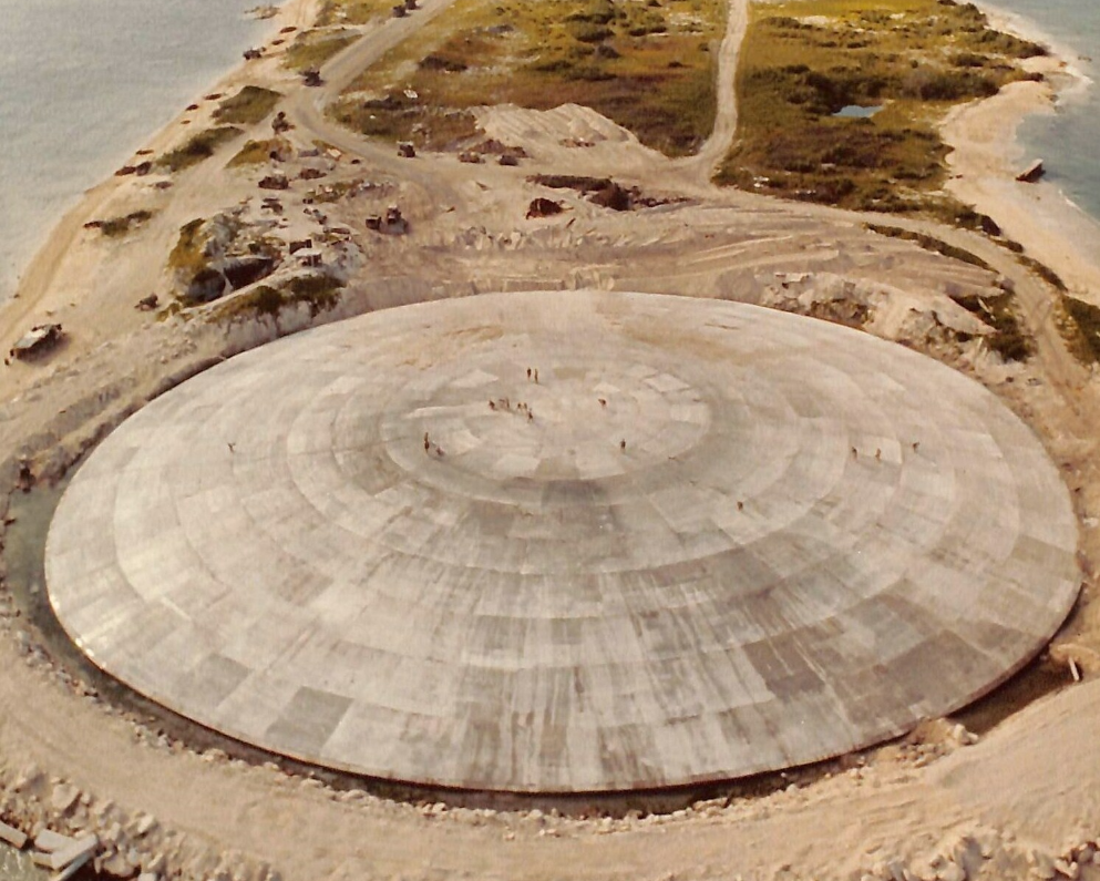
Bikini, meanwhile, was not cleaned up in the same way, radioactive contamination remained a major barrier to resettlement. The structure is still being monitored today.
A 2026 U.S. Department of Energy report examined its condition and analyzed groundwater around the site. DOE says the dome remains a major concern for the people of the Marshall Islands, while continued monitoring is required under U.S. law.
The United States continues to operate environmental monitoring and special medical programs in the Marshall Islands, decades after the last nuclear test, and has paid more than $300 million into various trust funds to compensate affected islanders and their descendants.
Today, the Marshall Islands is an independent country with its own government, while the United States retains responsibility for its defense under the Compact of Free Association.
Its nuclear testing era lasted just 12 years, its consequences have lasted far longer.