There is a peninsula in the coastal area of the Southern Philippines that has a natural shape resembling a lying dinosaur. The landform located in Mati City within Davao Oriental Province is known as Sleeping Dinosaur.
The elongated landmass juts directly into the sea waters in the southeastern part of Mindanao Island. Its hilly contours form a silhouette visible from a distance along the coastline of Mati City.
The Hilly Silhouette Resembling a Lying Dinosaur
The naming of Sleeping Dinosaur refers to the natural shape of the hill ridge that looks like a dinosaur in a lying position. The silhouette of the landmass appears elongated above the coastal waters of Mati City.
Based on its geographical orientation, the base of the landmass on the western side has wide and elevated land contours. The hilly section on the western side forms a silhouette resembling the back to the body of a dinosaur.
Shifting to the middle section, the land contour narrows and slopes down so it looks like an elongated neck. The narrowing landmass then continues eastward and forms a tip resembling a head facing the bay waters.
The hilly contours border directly on the sea surface in the bay area. The elevation difference between the hilly land and the sea level makes the silhouette line from the back to the head tip visible from afar.
The upper surface of the hills on the peninsula is dominated by expanses of grassland and coastal shrubs. The minimal cover of tall trees on the hill ridge makes the outer contour line of the hills clearly visible.
Observing the Landform from the Heights of Badas Point
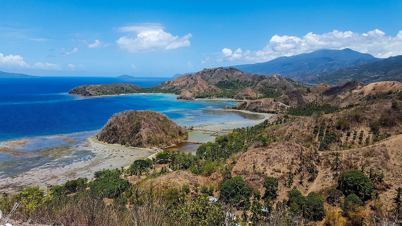
To see the entire dinosaur silhouette shape, observation is carried out from a highland named Badas Point. The observation point located in the Barangay Badas area sits at a higher elevation than the peninsula surface.
The location of Badas Point sits right beside the national coastal highway known as the Surigao–Davao Coastal Road. The highland position along the main transportation route faces directly south and southeast toward the bay waters.
The Badas Point highland area sits atop a coastal cliff facing directly toward the northern shoreline of Pujada Bay. From the elevation of the coastal highway, the line of sight extends unobstructed toward the bay waters without being blocked by tall buildings.
From the observation viewpoint on the northern side, the position of the dinosaur head tip appears on the left or eastern side. Meanwhile, the wide back section appears on the right or western side from the direction of the observation point.
The local government has built an official viewing platform facility in the Badas Point area named the Sleeping Dinosaur View Deck. The open viewing deck facility functions as a visual observation point for the peninsula landscape in Pujada Bay waters.
The Peninsula Position Connected to the Mindanao Mainland
Regarding its administrative location, the Sleeping Dinosaur landform is situated in the coastal area of Barangay Dawan bordering directly on Barangay Badas in Mati City. In everyday terms, the landmass is often nicknamed an island because its silhouette appears separated when viewed from a distance.
Based on geographical classification, the landform is actually a peninsula rather than a standalone island. The western side of the landmass is still connected directly to the main island of Mindanao through a low-lying isthmus.
As a peninsula, the Sleeping Dinosaur landmass juts directly into the waters of Pujada Bay on the southeastern coast of Mindanao. Around the same bay waters, there are also several small islands such as Pujada Island and Waniban Island.
In addition to having a dinosaur-shaped landmass, the waters of Pujada Bay surrounding the peninsula hold official conservation area status from the Philippine government. The marine area was designated as the Pujada Bay Protected Landscape and Seascape by President Fidel V. Ramos through Proclamation No. 431 on July 31, 1994.