
When we talk about Southeast Asia, we often picture crowded capitals, buzzing street food scenes, or idyllic island escapes. But if you zoom out and look at land area alone, some of the region’s largest provinces may surprise you. A new chart from Seasia Stats reveals that the biggest subnational regions aren’t where most people would guess — and they’re massive.
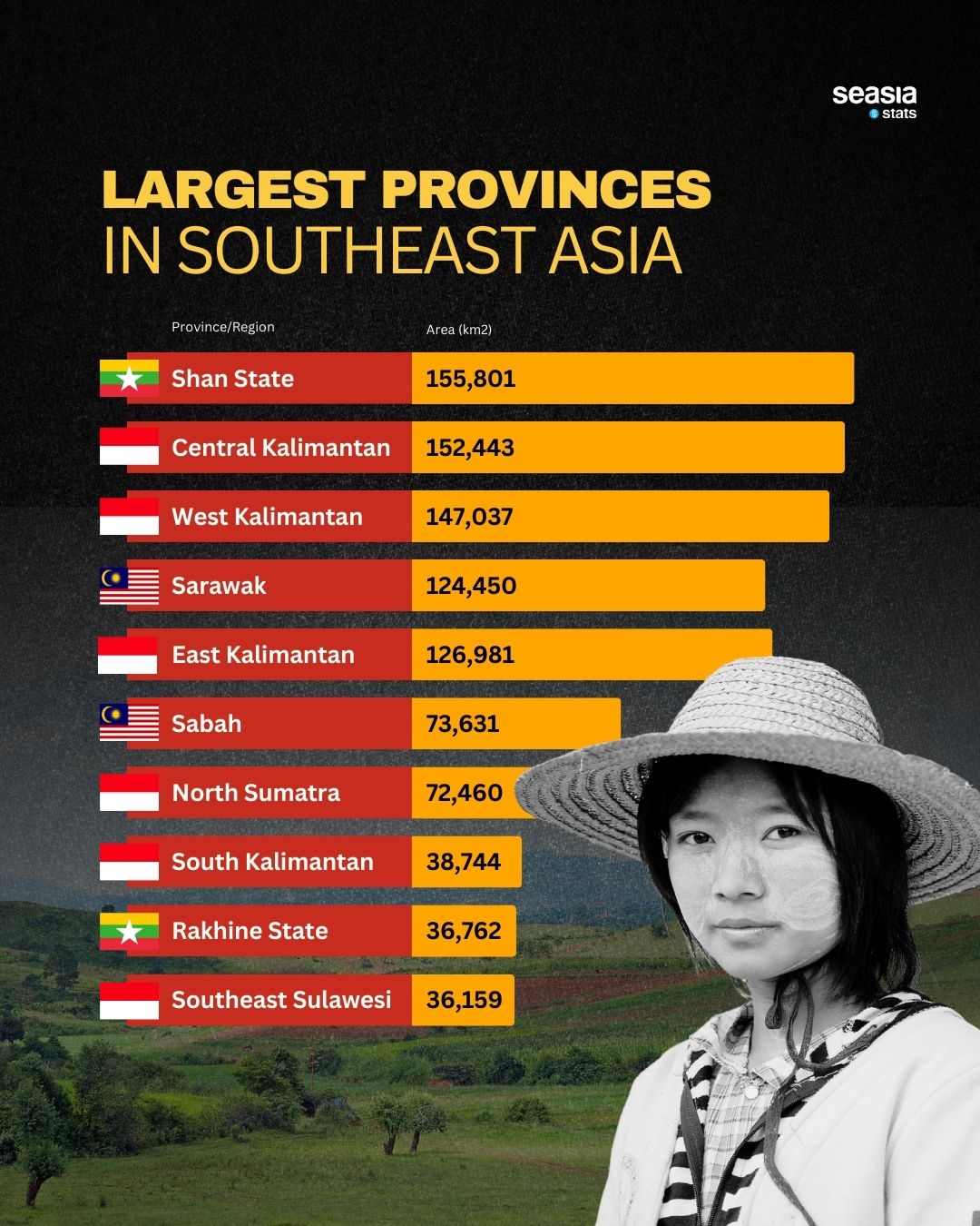
Shan State in Myanmar takes the crown with a staggering 155,801 km², making it larger than entire countries like Bangladesh or Nepal. Hot on its heels are Central Kalimantan (152,443 km²) and West Kalimantan (147,037 km²), both part of Indonesia’s Borneo territory. These provinces aren’t just large — they’re filled with tropical rainforests, indigenous cultures, and natural resources that are vital to the region’s future.
Indonesia, Malaysia, and Myanmar Lead the List
Unsurprisingly, Indonesia dominates the list, claiming six out of the top ten spots, thanks to its sprawling geography that stretches across Sumatra, Kalimantan, and Sulawesi. Meanwhile, Malaysia’s Sarawak and Sabah also make an impressive appearance — both located on Borneo — and Myanmar rounds things out with Rakhine State joining Shan.
These provinces are more than vast swaths of land. They’re homes to rich biodiversity, indigenous communities, and critical environmental challenges. As Southeast Asia continues to urbanize and develop, these massive regions are set to play increasingly important roles — from climate action to resource management.


