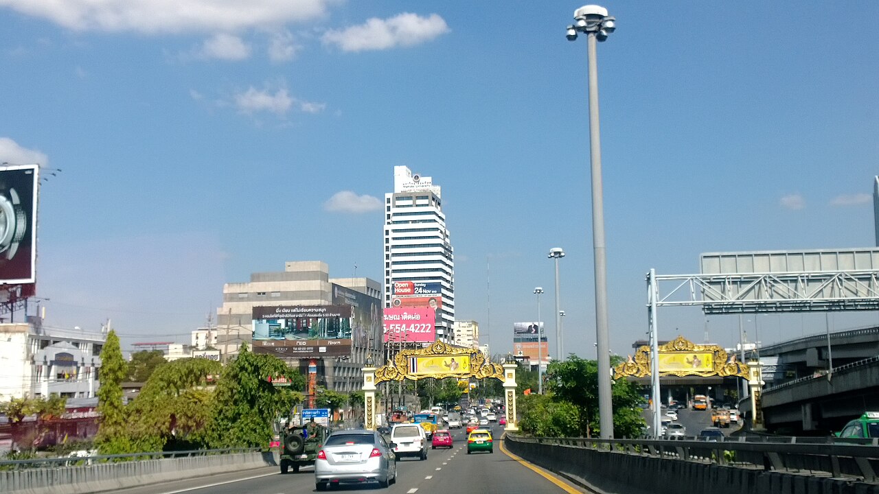
Look up while driving through Bangkok, and the skyline tells a story before any road sign does. Concrete pillars rise from sidewalks. Highways float above highways. In some stretches, three layers of road stack on top of each other.
Bangkok is home to one of the densest elevated expressway networks in Southeast Asia and one that includes the Bang Na Expressway, a 54 kilometer elevated toll road recognized by the Guinness World Records as the longest road bridge on Earth.
And, the story all began when the city ran out of room.
A City That Grew Faster Than Its Road
Bangkok's economic transformation began accelerating in the 1960s. The Thai government launched its first National Economic and Social Development Plan in 1961, drawing large volumes of foreign investment into the capital.
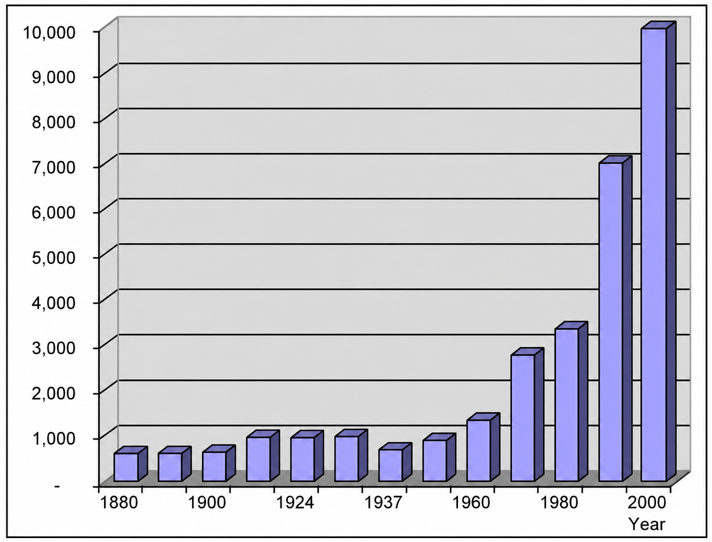
The result was rapid urbanization. Bangkok's population climbed from roughly one million in 1950 to over three million by 1970, driven by sustained migration from rural provinces.
As the city expanded, so did car ownership. Government policy from the 1960s onward prioritized automobile infrastructure, channeling resources into road paving, bridge construction, and highway extensions. But Bangkok had a structural problem that road expansion alone could not solve.
Only eight percent of Bangkok's total land area consisted of roads, far below the 20 to 30 percent typical of most Western cities. In a densely built urban core where land was expensive and communities already occupied most available space, horizontal expansion had hard limits.
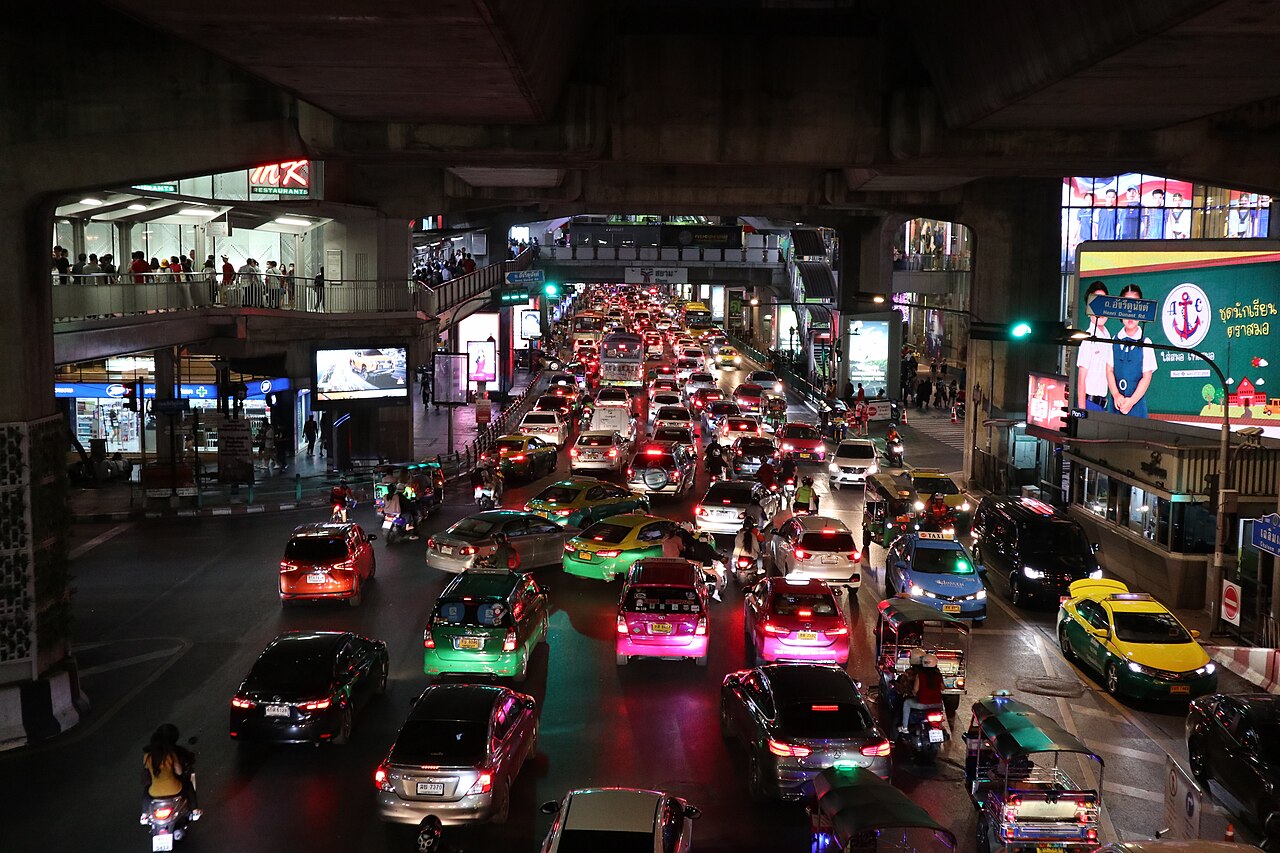
By the late 1970s, the city had already earned the label "city of traffic disaster." Car ownership kept rising. Road capacity did not keep pace. The gap between the two produced gridlock that worsened each year through the 1980s.
The Decision to Go Vertical
Planning for elevated highways in Bangkok dates back to the Greater Bangkok Plan of 1960. The institutional framework came into place on November 27, 1972, when the government established the Expressway Authority of Thailand (EXAT) as a state enterprise under the Ministry of Transport.
EXAT was tasked with building high capacity controlled access highways above the city's existing street grid. Construction on Thailand's first expressway began in 1978.
Total investment for the first stage reached 8.51 billion baht, with funding from the Thai government and Japan International Cooperation Agency (JICA).
The first section connecting Din Daeng to Tha Ruea opened on October 29, 1981. The logic was straightforward, if land at ground level was too scarce and too costly, the solution was to build above it.
Scale That Grew Over Decades
The network did not stop at the first expressway. In 1983, the private Bangkok Expressway Public Company Limited (BECL) was established to expand capacity further through public-private partnerships with EXAT.
Under Build Transfer Operate concessions, EXAT handled land acquisition while BECL managed design, construction, and operations. The first toll collection under this arrangement began in August 1987.
By 2015, EXAT managed seven expressways and four connecting links covering 207.9 kilometers. As of 2024, the figure had grown to eight main expressways and four links spanning 224.6 kilometers, with 11 additional projects valued at 273.29 billion baht in the pipeline.
The Bang Na Expressway, opened in February 2000, became the most visible product of this expansion. Built at a cost of over one billion US dollars and constructed using 1.8 million cubic meters of concrete.
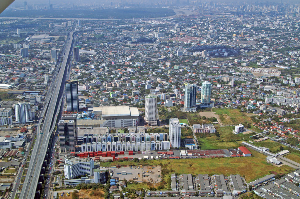
Its 54 kilometers of sixlane elevated road runs directly above National Highway Route 34, a highway built on top of a highway.
Numbers Behind the Skyline
Together, the BEM operated expressway sections alone cover more than 100 kilometers of roadway, forming what BEM describes as one of the densest toll expressway systems in Southeast Asia.
Thailand also holds the distinction of having the most extensive road transportation network in Southeast Asia overall, with more than 390,000 kilometers of roads across the country.
Bangkok's elevated expressways are the physical record of a city that grew faster than its ground could accommodate and the engineering response that followed.