Here's a fun bit of scale to wrap your head around, Indonesia has built a toll road so long that it's nearly as long as the width of Laos, a whole country.
To be clear from the start, this comparison only works one way. Measure Laos differently, and the country is actually much longer than the road. So let's unpack both sides of this properly.
First, Where Even is This Road?
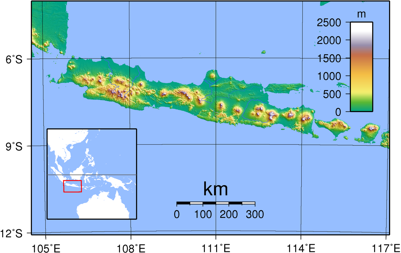
Indonesia is a vast archipelago, and Java is its most populous island, home to the capital Jakarta, along with major cities like Surabaya. Picture Java as a long island running roughly east-west, a bit like a stretched out sausage shape on the map.
The Trans-Java Toll Road is a chain of connected expressways that runs almost the entire length of that island, from Merak (a port town at Java's western tip, the gateway to the neighboring island of Sumatra) all the way to Probolinggo (a city on Java's eastern side, not far from the famous Mount Bromo volcano).
Along the way, it passes through Semarang and Surabaya, two of Java's biggest cities, plus a smaller town called Gempol near Surabaya where an early highway segment first opened.
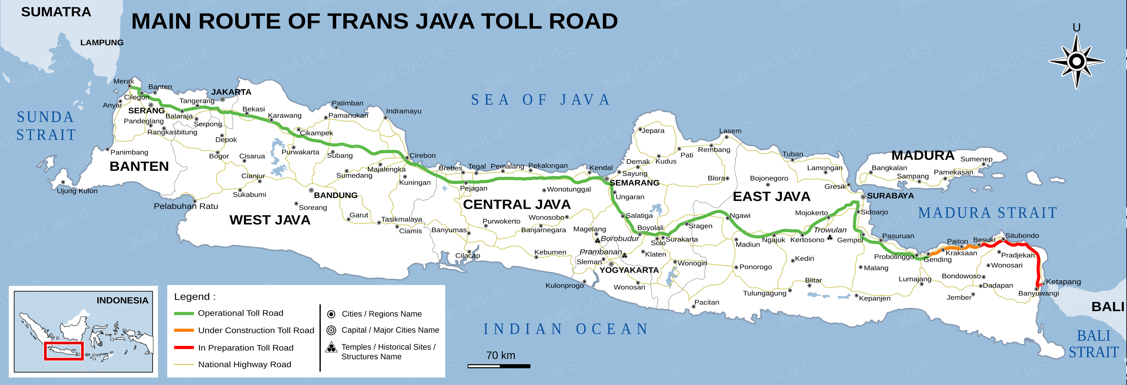
As of the end of 2023, according to Indonesia's Toll Road Regulatory Agency (BPJT), this connected network measured 1,065.5 kilometers, roughly the distance you'd drive from London to Vienna, or from Los Angeles to Portland, Oregon.
The Road Wasn't Built in One Go
Nobody woke up one day and built over a thousand kilometers of highway in one shot. It happened in pieces, over four decades:
- 1983-1986: Three short, unconnected sections opened first near Semarang, near Jakarta, and near Surabaya (the Surabaya-Gempol stretch).
- 2015–2019: The big push happened here. The government connected the missing links between Jakarta and points east, finally stitching the whole thing into one continuous route. By 2018, you could already drive an unbroken 933 km from Merak to a town called Grati, near Pasuruan in East Java. The final piece, extending it to Probolinggo, opened in 2019.
And it's still growing. Construction is underway to extend the road further east to Banyuwangi, the town at Java's easternmost tip where ferries cross to the island of Bali.
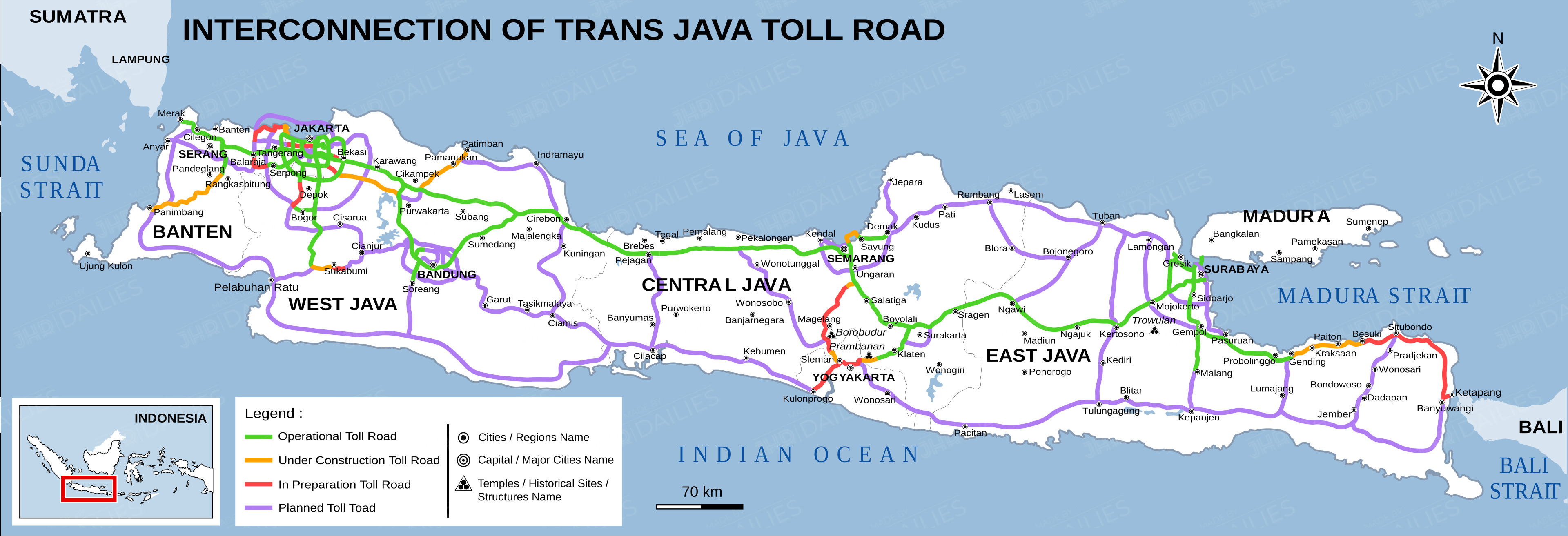
The first stretch of that extension, a 49.7 km piece connecting Probolinggo to a town called Besuki is part of that ongoing work. Once the whole thing is finished, official figures put the complete Merak to Banyuwangi corridor at somewhere between 1,150 and 1,167 kilometers, depending on which source and which connecting sections you count.
Now, About Laos
Laos is a landlocked country in Southeast Asia, and like Java, it isn't a neat square or circle. It's an oddly elongated shape, fairly round and chunky in the north, then it narrows into a long, thin tail stretching toward the southeast.
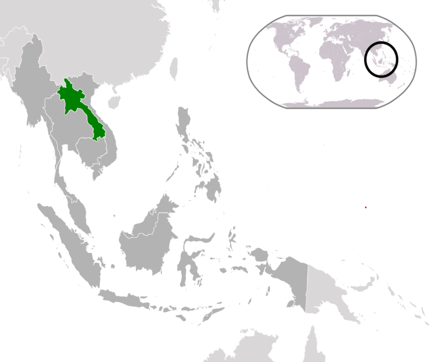
Because of that shape, there isn't just one obvious way to measure "how long" Laos is. Depending on which direction you draw your ruler across the map, you get very different answers:
- Measurement #1, Northwest to southeast (diagonal) ≈ 1,050 km. This describes Laos's extent along its northwest to southeast axis, following the general direction of the country's elongated shape. This is the figure commonly cited in country profiles, including Singapore's ASEAN Information Portal.
- Measurement #2, North to south ≈ 1,700 km. This is another commonly cited description of Laos's geographic extent, measuring the country from north to south. Laos's own Ministry of Public Works and Transport uses the 1,700 km figure, as do various international and academic sources.
Here's an easy way to picture why these numbers differ:
Think of Laos as an oddly shaped, elongated piece of paper. You can measure its extent along different axes, one running roughly northwest to southeast, and another describing how far the country stretches from north to south. Because those directions aren't the same, they produce different figures.
So against Laos's northwest to southeast extent of 1,050 km, the toll road at 1,065.5 km is nearly identical in length. Against the country's 1,700 km north to south extent, however, the road falls short by more than 600 km.
Neither figure is necessarily "wrong." They simply describe Laos's dimensions along different geographic axes.
Why This Comparison is Worth Making At All
It's easy for "1,065.5 kilometers" to feel like an abstract number on a government press release.
Comparing it to something as tangible as the length of an entire nation, even with the caveat about which direction you measure helps put Indonesia's infrastructure achievement into perspective.
Building over a thousand kilometers of continuous, drivable expressway across a single island, over roughly 40 years, is no small feat, and Laos happens to give us a strikingly close, real world yardstick for just how big that is.