In the Philippines, typhoons aren't a rare emergency, they're a fact of everyday life
The Philippine Atmospheric, Geophysical and Astronomical Services Administration (PAGASA) says around 20 tropical cyclones enter the Philippine Area of Responsibility (PAR) every year, with roughly 8 to 9 crossing the country.
That makes forecasting more than a scientific exercise. The earlier authorities can determine where a storm is heading and how strong it could become, the more time communities have to prepare.
But how does the Philippines actually predict the next typhoon?
To understand that, it helps to look first at where many of these storms begin. The waters east of the Philippines are among the most active breeding grounds for typhoons in Asia. Read more: The Philippine Sea, Where Many of Asia's Strongest Typhoons Begin.
It Starts in Space
One of PAGASA’s most important tools is not on the ground at all.
The agency receives data from Himawari-8 and Himawari-9, geostationary weather satellites operated by Japan’s Meteorological Agency.
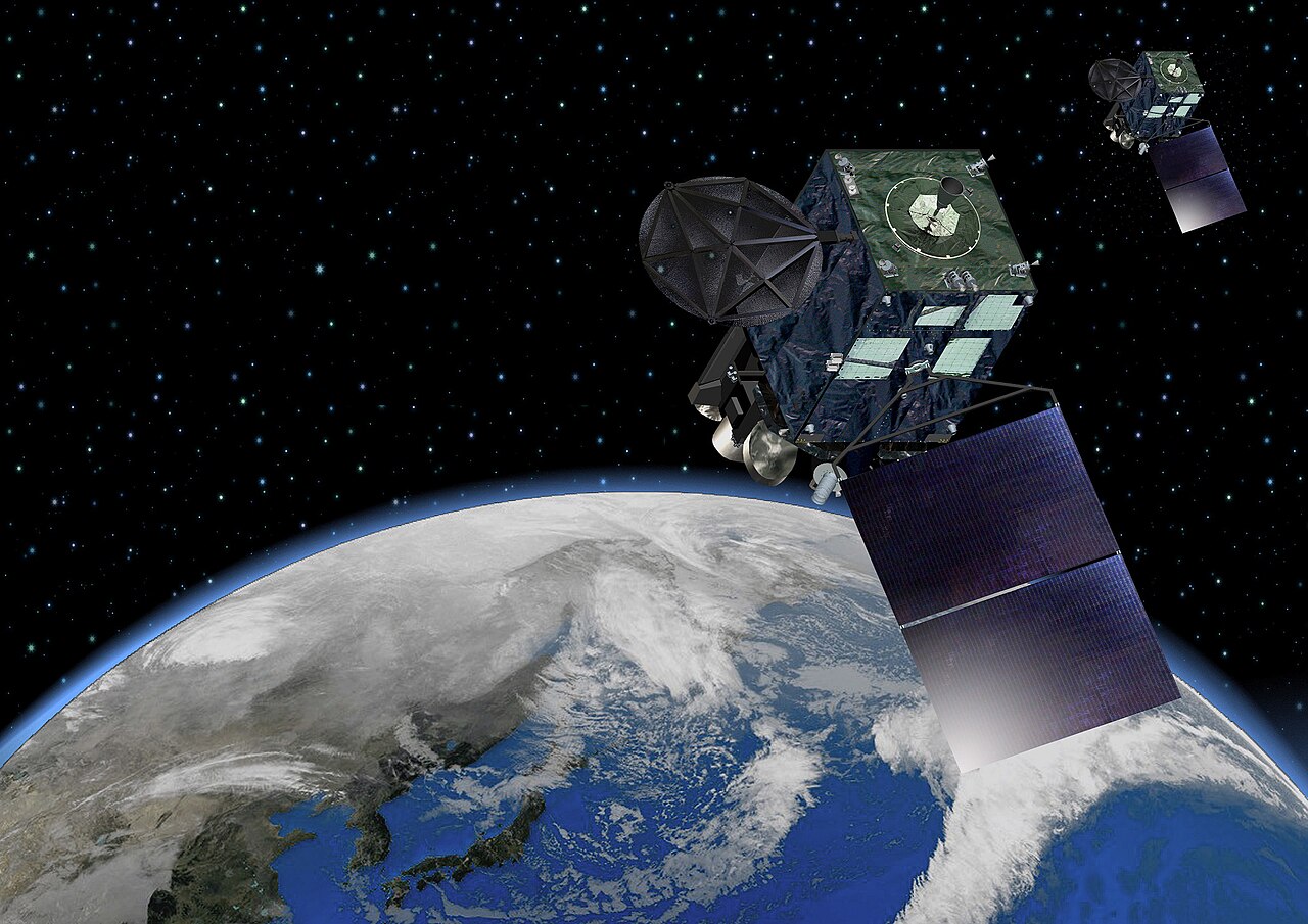
The satellites provide imagery as frequently as every 10 minutes, allowing forecasters to continuously monitor cloud systems, tropical disturbances and developing cyclones across the region.
From space, meteorologists can observe changes in a storm’s structure and movement that would be impossible to see from a single location on the ground. But satellites are only one piece of the puzzle.
Then Come the Radars
Once a storm gets closer, weather radar becomes increasingly important.
PAGASA operates a network of Doppler weather radars that can observe precipitation and provide information about the location and intensity of weather systems. Doppler technology can also measure the movement of precipitation particles, helping meteorologists estimate wind patterns within storms.
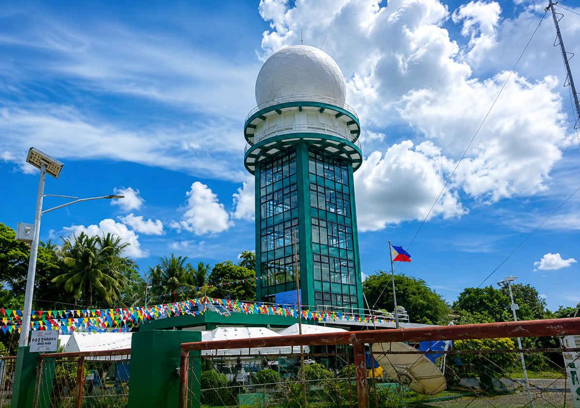
The technology continues to be upgraded.
In March 2026, PAGASA inaugurated an S-band dual polarization Doppler radar facility in Iloilo, designed to provide higher resolution, near real time observations of severe weather, including heavy rainfall and tropical cyclones.
Together, satellite imagery and radar give forecasters something crucial, observations of what the atmosphere is doing right now.
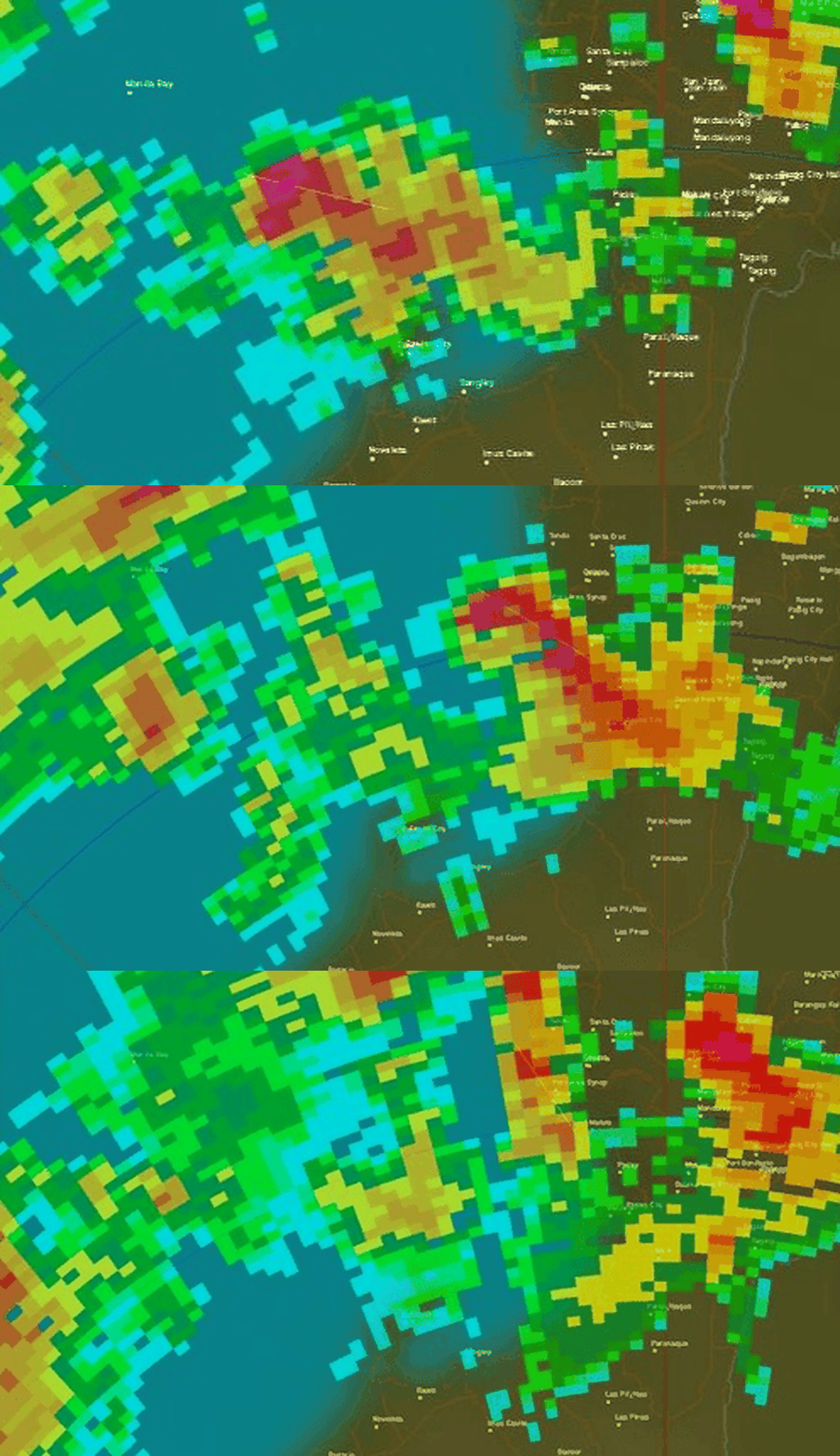
But forecasting requires something more.
Turning Weather Into Mathematics
This is where Numerical Weather Prediction (NWP) comes in.
Instead of simply looking at a storm and guessing where it will go, computers use mathematical models to simulate how the atmosphere is likely to evolve.
PAGASA operates its own numerical modelling systems, including PAGASA-WRF models at 12 kilometer and 3 kilometer resolutions, alongside global models. These models generate forecasts for variables such as rainfall, wind, temperature and atmospheric pressure.
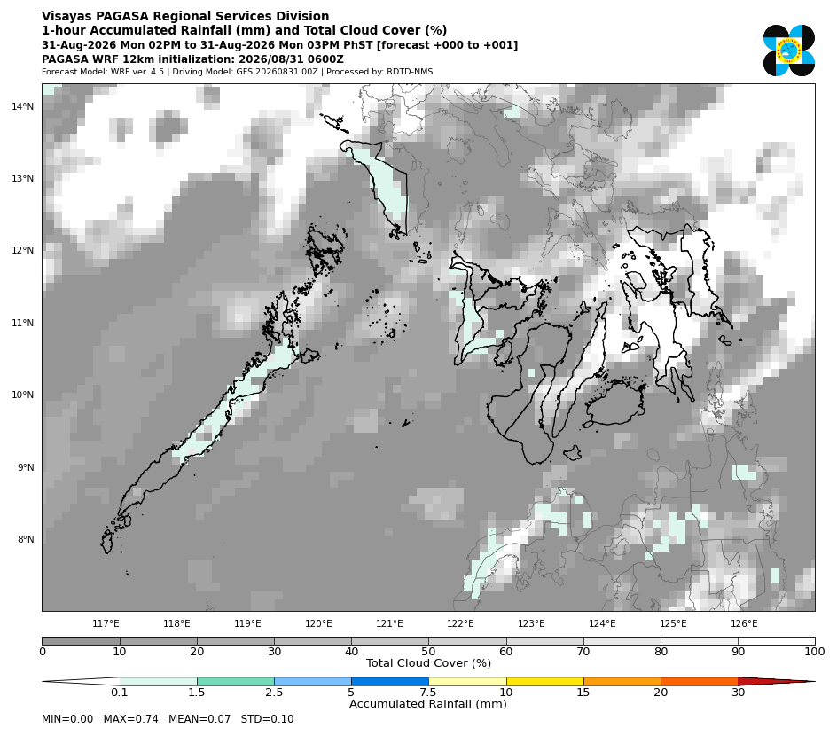
Think of it as creating a virtual atmosphere.
The model takes observations of the current atmosphere, processes them through physical equations and produces a forecast of what could happen next.
The higher resolution models can provide more detailed information over the Philippines, particularly for rainfall and other weather conditions.
Can It Predict a Typhoon Two Weeks Ahead?
To some extent, Yes, but not with certainty.
PAGASA has a Tropical Cyclone Threat Potential Forecast (TTPF) that assesses the potential for tropical cyclones to form within the PAR and provides guidance on possible movement for up to two weeks.
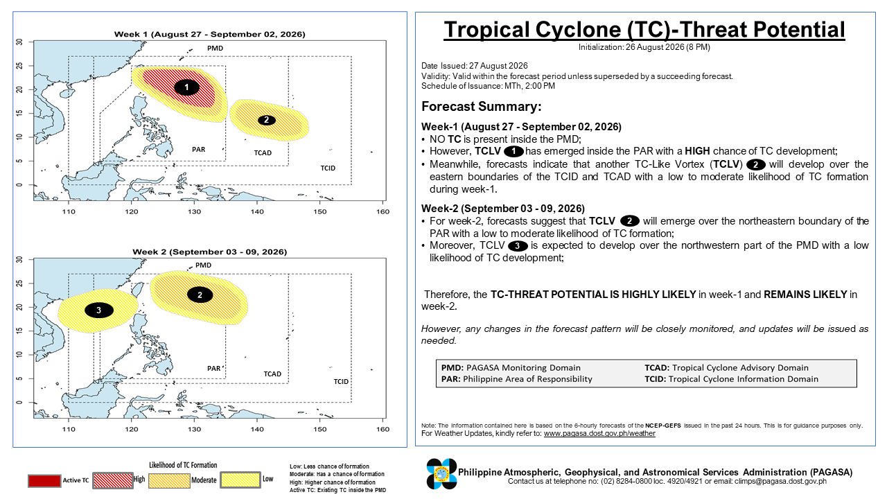
The system uses outputs from the National Centers for Environmental Prediction’s Global Ensemble Forecast System (NCEP-GEFS) together with tropical cyclone tracking algorithms.
But there is an important distinction.
A two week forecast does not mean PAGASA knows exactly where a typhoon will be on a specific day two weeks from now. Instead, it provides an early indication of where conditions may become favourable for tropical cyclone development and where a potential system could move.
As the storm develops and more observations become available, forecasts can be updated.
Humans Still Make the Final Call
Despite all this technology, the final forecast is not simply produced by a computer.
Meteorologists combine satellite observations, radar data, weather observations and numerical model outputs to assess what is actually happening in the atmosphere.
That matters because weather models are not perfect. Small differences in the initial atmospheric conditions can eventually produce significant differences in a storm’s projected path or intensity.
The result is a constantly updated chain.
For a country that faces roughly 20 tropical cyclones entering its monitoring area every year, that chain can translate directly into more time to evacuate, protect infrastructure and prepare communities.
Technology cannot stop the Philippines’ next typhoon. But it can help the country see it coming.